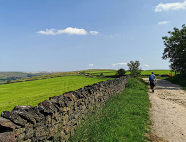
This hilly stage of the trail explores the stunning landscapes of Saddleworth, the little bit of Pennine Yorkshire included within Greater Manchester.
Highlights include:
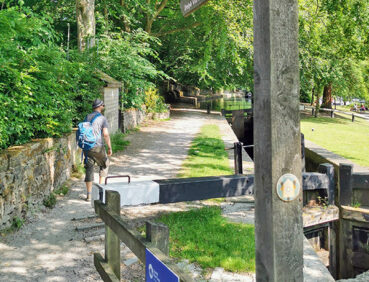
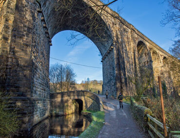
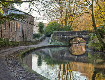
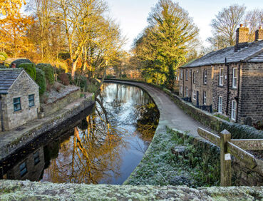
- A rustic section of the Huddersfield Narrow Canal
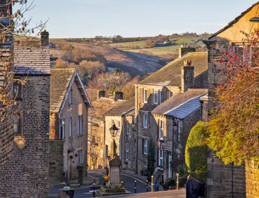
- The picture-postcard hilltop village of Dobcross
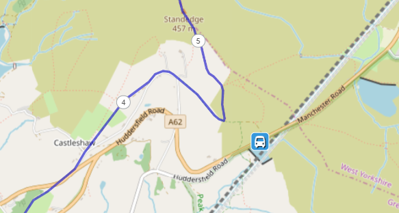
- Aerial views of the Roman fort site at Castleshaw
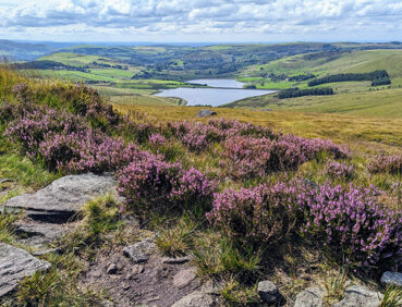
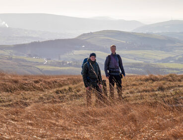
- A panoramic walk along the Standedge escarpment (part of the Pennine Way)
- Crompton Moor and Crompton Fold country park, with its woodlands and waterfall.
Note that parts of the trail may be damp, muddy and slippery at any time of year and especially after periods of wet weather. Please bear this in mind when planning your trip.
Be sure to keep your dog on its lead in sensitive areas, which include upland areas such as moorland, wetlands and mosslands, farmland, and parkland. Keeping dogs on leads helps protect both livestock and wildlife, especially ground-nesting birds.
This walk is available on the user-friendly Go Jauntly walking app. Here, photographs and written directions will enable you to follow the route on your phone. You can also download a printable PDF of the directions from the same link.
Alternatively, you can follow the route (without written directions) on the mobile-friendly Plotaroute site. To use Plotaroute on your phone’s browser, simply click the map. Then, when you’re ready to start walking, click the tracker icon (bottom right) to show your position as you follow the route.
We recommend carrying an additional power source and/or map when following online routes on your phone. For any challenging routes, we would recommend that you also have access to and know how to read an Ordnance Survey map.
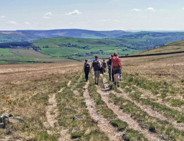
The route includes a total ascent of more than 500 metres. The walk is therefore best suited to experienced walkers with navigation and map-reading skills and could be challenging in poor visibility. While the initial climb from the canal, via Dobcross village, to Harrop Edge is fairly steep, most of the remaining ascents and descents are more gradual on well-made paths.
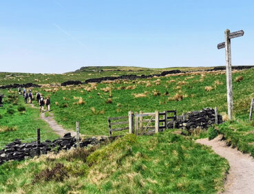
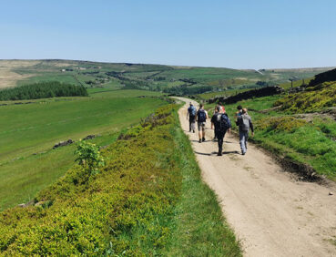
Overall, most of the paths used are of good quality (including the partially cobbled canal towpath and the regularly maintained Pennine Way sections). However, where the GM Ringway leaves the Pennine Way (after the 6-mile/9-km point), the paths on Castleshaw Moor, can be very boggy. The grassy paths used on the optional short diversion to the waterfall in Crompton Fold Country Park can also be very damp. Mud and puddles are also likely to be encountered elsewhere.
There are several stiles to be negotiated on the final 1.5 miles / 2.3 km from Crompton Fold to Newhey. You will also need to be mindful of vehicles on the approach to Denshaw, where you walk on roads without pavements.
The paths and terrain encountered on this walk are shown and described on the Go Jauntly version of the walk, enabling you to make your own assessment of whether the route is accessible for you.
However, the varied terrain involved in this route means that the overall route is not suitable for wheelchairs or pushchairs. Please visit our Shorter walks page for a selection of step-free walks on the GM Ringway trail.
Toilets are available at the walk start at Greenfield station (including an accessible toilet requiring a RADAR key) during station opening hours. At the 2-mile (3.2-km) point, there are also toilets by the canalside café. In addition, there are pubs, cafes and shops in both Greenfield and Uppermill (on the first part of the route). Subsequently, there are pubs in the hilltop village of Dobcross, at the 8.5-mile (13.5-km) point in Denshaw village, and the end of the walk in Newhey.
As the GM Ringway is designed around the tram, train and bus network, we recommend the use of public transport to access the start and end points. However, we also provide tips for drivers below.
Start and end points
To work out how to get to and from the walk start end points, simply click the links below to see the location in Google Maps. Then click ‘Directions’ and enter your starting location. For public transport options, click the train icon.
Start point: Greenfield station OL3 7JZ
End point: Newhey tram stop OL16 3RN
Alternatively, input the locations shown on this page into the TfGM journey planner.
Public transport
This trail stage connects Greenfield station, served by direct trains from Manchester (but not Oldham) with Newhey tram stop, served by Metrolink trams from Manchester, Oldham and Rochdale. Both locations also have bus stops nearby. Train times can be checked by visiting the National Rail website, while details of bus and tram services can be found on the TfGM journey planner.
Recommended tickets
You can check the price of a single train ticket to or from your local station to Greenfield on the National Rail website. Tickets can be purchased online or from the ticket office or machine at the station.
For your tram journey, you will need a Metrolink ticket from Newhey cover the zones you travel through. You can check the price of these on the Bee Network website and then purchase your ticket from the machine at the stop or tap in and out with your bank card.
However, as you will be travelling by a mix of trains and trams (and possibly buses), then a combined day ticket might be cheaper. Check the TfGM Tickets and passes page to find the best option (selecting ‘1 day and return’ as your answer to ‘How often would you be travelling?’).
Parking
As the start and end points are on different train lines, drivers may find it easiest to park at their local station and travel by train to Greenfield and return by tram from Newhey. See ‘Public transport’ above.
Otherwise, the best option is to park at Oldham Mumps Metrolink Park & Ride in Oldham town centre (postcode OL1 3TZ), where there is parking for 238 vehicles and 16 disabled spaces. From Oldham Mumps interchange, you can travel by bus to the walk start at Greenfield station and return by direct tram from Newhey. Details of bus and tram services can be found on the TfGM journey planner.
Cut-off points
If, for example, you only want to walk a section of the stage, there are a two main locations where public transport can be used to leave or to access the route.
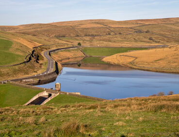
The first is on the A62 near Brun Clough Reservoir, not far from the 4.5-mile (7.5-km) point, from where buses run to Greenfield and Oldham.
The second is in Denshaw village, at the 8.5-mile (13.5-km) point, also served by buses to Greenfield and Oldham:

For further details, see the Plotaroute map.
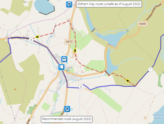
One alternative route is shown on the Plotaroute map. This involves remaining on the Oldham Way to the east and north of Denshaw village. However, this route was partially unsafe and difficult to follow as of late 2023 and we are therefore recommending the main route via Denshaw, where refreshment opportunities are in any case available.
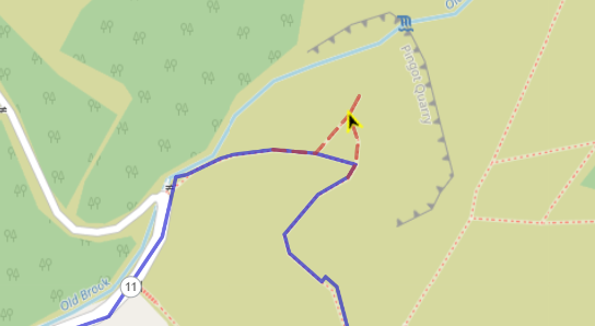
The Plotaroute map also shows a very short (100-metre) extension at Crompton Fold, giving you the chance to visit the pretty waterfall in the old Pingot Quarry. This is also described in the Go Jauntly app route:
To give any feedback or notify us of any issues with this route, please complete this form.