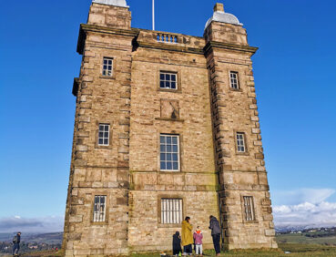
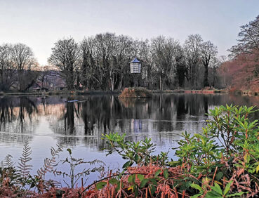
This scenic route takes walkers right to the edge of the Peak District via some very attractive landscapes. The route uses lovely paths to explore the National Trust’s Lyme estate and its famous hall.
Highlights include:
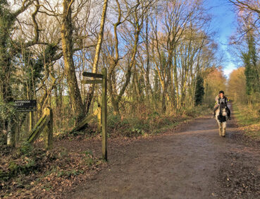
- Colourful forest paths in Middle Wood and Disleybank Wood
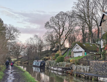
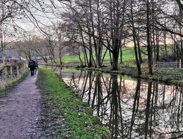
- Sections of the pretty Macclesfield and Peak Forest Canals
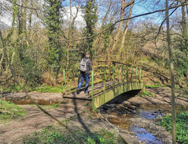
- Quiet paths along Bollinghurst Brook
- Heritage and parkland scenery in the National Trust’s Lyme estate with its Grade I-listed hall
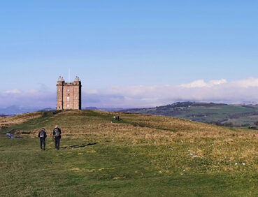
- Fine views towards Mellor Moor and the Peak from Marple Ridge
- The old textile-printing settlement of Strines.
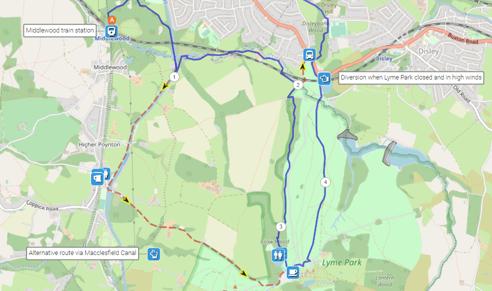
Lyme Park is normally open all day every day but closes around twilight and in high winds. Please visit the National Trust website to check that the park will be open for the duration of your walk through it. See ‘Diversions and trail updates below’ for details of a shortcut avoiding the park if necessary.
Note that parts of the trail may be damp, muddy and slippery at any time of year and especially after periods of wet weather. Please bear this in mind when planning your trip.
Be sure to keep your dog on its lead in sensitive areas, which include upland areas such as moorland, wetlands and mosslands, farmland, and parkland such as National Trust estates. Keeping dogs on leads helps protect both livestock and wildlife, especially ground-nesting birds.
This walk is available on the user-friendly Go Jauntly walking app. Here, photographs and written directions will enable you to follow the route on your phone. You can also download a printable PDF of the directions from the same link.
Alternatively, you can follow the route (without written directions) on the mobile-friendly Plotaroute site. To use Plotaroute on your phone’s browser, simply click the map. Then, when you’re ready to start walking, click the tracker icon (bottom right) to show your position as you follow the route.
We recommend carrying an additional power source and/or map when following online routes on your phone. For any challenging routes, we would recommend that you also have access to and know how to read an Ordnance Survey map.
The route includes more ups and downs than the previous stages, especially in Lyme Park and Disleybank Wood. Although many of the paths are well-made with a mix of surfaces, some will be muddy and slippery after wet weather, especially on any riverside sections.
The paths and terrain encountered on this walk are shown and described on the Go Jauntly version of the walk, enabling you to make your own assessment of whether the route is accessible for you.
Because of the varied terrain, the overall walk is not wheelchair or pushchair-friendly. However, the varied terrain involved in this walk means that the overall route is not suitable for wheelchairs or pushchairs. Please visit our Shorter walks page for a selection of step-free walks on the GM Ringway trail. There are also several fully accessible paths within Lyme Park as well as a large play area for children. Check the National Trust website for further details.
There are public toilets (including accessible facilities] and several refreshment options within Lyme Park at the 3-mile (4.5-km) point. Apart from these, pubs and cafes close to the route are shown on the Plotaroute map.
As the GM Ringway is designed around the tram, train and bus network, we recommend the use of public transport to access the start and end points. However, we also provide tips for drivers below.
Start and end points
To work out how to get to and from the walk start end points, simply click the links below to see the location in Google Maps. Then click ‘Directions’ and enter your starting location. For public transport options, click the train icon.
Start point: Middlewood station SK12 1UA
End point: Strines station SK22 3AL
Alternatively, input the locations shown on this page into the TfGM journey planner.
Public transport
This trail stage connects Middlewood station, served by direct trains from Manchester and Stockport, with Strines station, with services to Manchester but not Stockport. Note that services can be infrequent especially on Sundays, particularly to Middlewood.
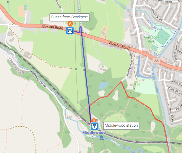
Some users (especially in the Stockport area) may wish to make all or part of their journey by bus. Frequent services from Stockport run along the A6 (Buxton Road) towards High Lane and Buxton. Get off at the Threaphurst Lane stop and walk a short way further along Buxton Road. Descend left from it onto the signposted Middlewood Way. Turn right and, in 0.5 miles / 800 m, you will reach the walk start at Middlewood station.
The end of the stage crosses Strines Road, from where buses return to Stockport, as shown on the Plotaroute map.
Train times can be checked by visiting the National Rail website, while details of bus and tram services can be found on the TfGM journey planner.
Recommended tickets
If you are travelling only by train from locations within Greater Manchester, you can purchase single tickets from your starting location to Middlewood and from Bramhall. You can check the price of these on the National Rail website. Tickets can be purchased online or from the ticket office or machine at the station.
Depending on your starting location, a Greater Manchester Rail Ranger may be cheaper. This can be used on any train (and trams within the city centre) all day on weekends and bank holidays at off-peak times on weekdays. For details, see this page.
If you are travelling by a mix of trains, buses or trams, then a combined day ticket might be cheaper. Check the TfGM Tickets and passes page to find the best option (selecting ‘1 day and return’ as your answer to ‘How often would you be travelling?’).
Parking
As the start and end points are on different train lines, drivers are advised to park at their local station and travel by train to Middlewood and from Strines. See ‘Public transport’ above.
Otherwise, the best option is to park in Stockport town centre. Multiple car parks are available, with many detailed on the Stockport Council website. From there, it’s easiest to take a direct train to Middlewood. As services can be infrequent, check the National Rail website. Alternatively, take a Buxton-bound bus to the Threaphurst Lane stop on the Buxton Road (A6). Again, see ‘Public Transport’ above for details of the short walk from here to Middlewood station.
The end of the stage crosses Strines Road, from where buses return to Stockport, as shown on the Plotaroute map.
Cut-off points
If, for example, you only want to walk part of this stage, by far the most straightforward access point is where the route crosses the main Buxton Road (A6) on exiting the National Trust Lyme Estate. Frequent buses run between this point and Stockport town centre. Alternatively, Disley train station (not in the Greater Manchester zone) lies approximately 500 metres to the east. For details, see the Plotaroute map.
Two alternative optional routes are shown on the Plotaroute map.
The first optional alternative is an attractive route allowing you to continue southwards along the Macclesfield Canal and then use Lyme Road and the subsequent path to enter Lyme Park at the southern car park:
The Go Jauntly app also has details of this diversion.
The map above also shows the second alternative route avoiding the National Trust Lyme estate when it is closed (for example in high winds or outside opening hours). This shortens the length of the stage substantially. Whichever route you follow, please visit the National Trust website to check that Lyme is open before you start your walk.
To give any feedback or notify us of any issues with this route, please complete this form.
Peak & Northern Footpaths Society (PNFS) is a members-driven charity committed to protecting the rights of users of rights of way and public access land.
PNFS erects and maintains its own distinctive signposts and you can see four of these on Stage 5 at:
*Canal Bridge 13,1km S of A6 at High Lane PNFS’s map location and grid reference
*Farm Bridge,Coppice Lane at Bollinhurst Brook, Disley PNFS’s map location and grid reference
*Peak Forest Canal towpath PNFS’s map location and grid reference
*Towpath 400m WSW of Strines PO PNFS’s map location and grid reference
PNFS are working closely with the GM Ringway to help respond to problems that you may encounter with the trail condition, including reporting issues to the relevant local authority.
To read more about PNFS visit their website at https://peakandnorthern.org.uk/ and for any issues relating to the trail condition, we would recommend you contact PNFS directly either by using the Path Checker app or via the PNFS website: Peak & Northern Footpaths Society – Report a problem (or Lost Way) (peakandnorthern.org.uk).