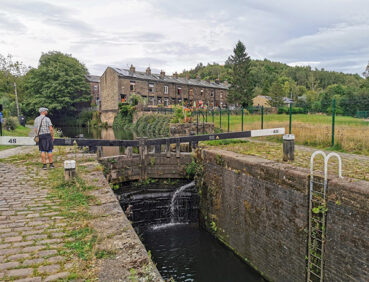
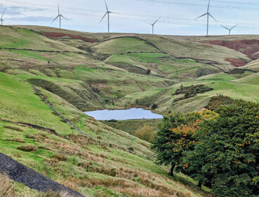
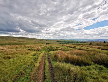
This adventurous stage offers lovely moorland walking interspersed with canals, reservoirs and waterfalls.
Please note two major diversions on this walk – at the start and in Healey Dell – during spring and early summer 2026. See ‘Detours and trail updates’ below.
- Highlights include:
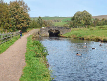
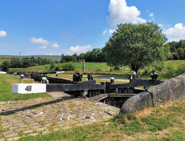
- A pretty section of the Rochdale Canal
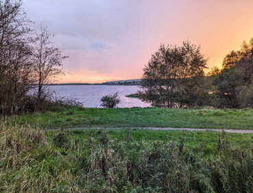
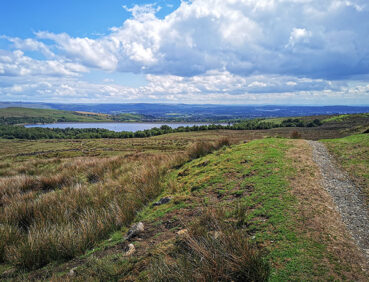
- The shores of the expansive Watergrove Reservoir
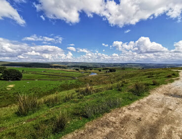
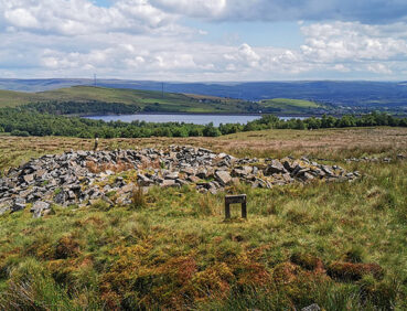
- Panoramic views from the Pennine Bridleway and from the ‘Cotton Famine Road’ on Rooley Moor
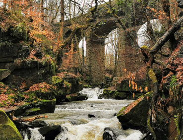
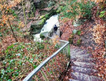
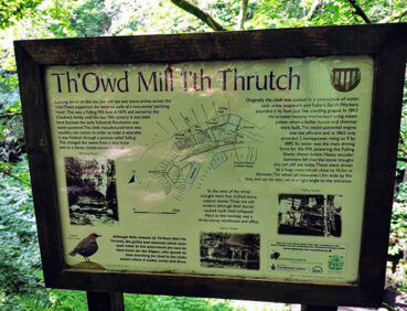
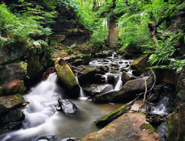
- A full circuit of the gorge-like Healey Dell, with its spectacular waterfalls and dramatic railway viaduct
- Beautiful views over Greenbooth Reservoir.
Note that parts of the trail may be damp, muddy and slippery at any time of year and especially after periods of wet weather. Please bear this in mind when planning your trip.
Be sure to keep your dog on its lead in sensitive areas, which include upland areas such as moorland, wetlands and mosslands, farmland, and parkland. Keeping dogs on leads helps protect both livestock and wildlife, especially ground-nesting birds.
This walk is available on the user-friendly Go Jauntly walking app. Here, photographs and written directions will enable you to follow the route on your phone. You can also download a printable PDF of the directions from the same link.
Alternatively, you can follow the route (without written directions) on the mobile-friendly Plotaroute site. To use Plotaroute on your phone’s browser, simply click the map. Then, when you’re ready to start walking, click the tracker icon (bottom right) to show your position as you follow the route.
We recommend carrying an additional power source and/or map when following online routes on your phone. For any challenging routes, we would recommend that you also have access to and know how to read an Ordnance Survey map.
The route includes a substantial total ascent of more than 500 metres. However, it does not go as high as the previous stages and most of the climbing is gradual and on well-made paths (such as the Pennine Bridleway. It therefore has a less challenging feel than some of the other Pennine stages.
Many of the paths used are broad, clear but sometimes stony paths. Some narrower grassy paths, for example after the 1-mile/1.6-km point west of Todmorden Road and in the woodland in Broadley on the approach to Healey Dell.
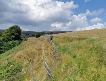
Bikes and horses may be encountered on the Pennine Bridleway sections. Mud and puddles are likely on certain sections.
The paths and terrain encountered on this walk are shown and described on the Go Jauntly version of the walk, enabling you to make your own assessment of whether the route is accessible for you. However, the varied terrain involved in this trail stage means that the overall route is not suitable for wheelchairs or pushchairs. Please visit our Shorter walks page for a selection of step-free walks on the GM Ringway trail.
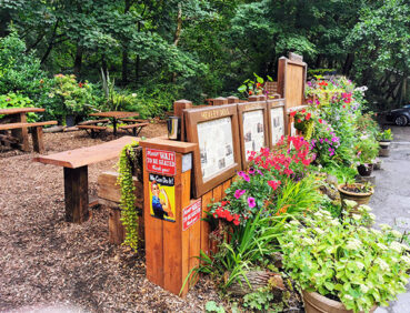
In addition, some of the paths around Healey Dell are step-free and suitable for all users (but may require a RADAR key in places). For details see the map on the Healey Dell Tearooms website.
The only public toilets en route can be found at the 7.5-mile 12.5-km point in Broadley, shortly before the descent to Healey Dell. There are also pubs and cafes in Littleborough at the start of the walk, a cafe/takeaway in Broadley, the tearooms in Healey Dell, and a pub, café, and fish and chip shop in Norden at the end of the walk. For location details, see the Plotaroute map.
As the GM Ringway is designed around the tram, train and bus network, we recommend the use of public transport to access the start and end points. However, we also provide tips for drivers below.
Start and end points
To work out how to get to and from the walk start end points, simply click the links below to see the location in Google Maps. Then click ‘Directions’ and enter your starting location. For public transport options, click the train icon.
Start point: Littleborough station OL15 8AR
End point: OL11 5TT
Alternatively, input the locations shown on this page into the TfGM journey planner.
Public transport
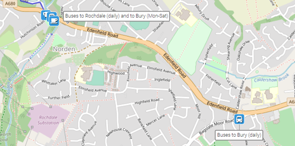
This trail stage connects Littleborough, served by direct trains from Manchester and Rochdale (and also buses from Rochdale), with Norden, served by buses from Rochdale and Bury.
Note that the actual finish point at Norden (Hutchinson Road bus stop) has buses every day to Rochdale but to Bury only on Mondays to Saturdays. If you wish to take the bus to Bury on a Sunday, you will therefore need to walk 0.7 miles / 1 km east along Edenfield Road at the end of the walk to reach the Bagslate Moor Road stop:
Train times can be checked by visiting the National Rail website, while details of bus and tram services can be found on the TfGM journey planner.
Recommended tickets
You can check the price of a single train ticket from your local station to Littleborough on the National Rail website. Tickets can be purchased online or from the ticket office or machine at the station. If you are based within the Rochdale, you could alternatively travel only by bus to Littleborough and from Norden. Buses within Greater Manchester cost £2 for a single ticket and £5 for an AnyBus ticket, valid for multiple bus journeys all day and obtainable from the driver (prices correct as of March 2024).
However, as you are likely to be travelling on a mix of trains and buses (and possibly trams), then a combined day ticket might be cheaper. Check the TfGM Tickets and passes page to find the best option (selecting ‘1 day and return’ as your answer to ‘How often would you be travelling?’).
Parking
For drivers, the best option is to park at Rochdale Railway Station Metrolink Park & Ride (postcode OL11 1JL), where there is parking for 202 vehicles and 13 disabled spaces. From there, you can travel by train or bus to Littleborough station and return by bus from Norden to Rochdale. Details of bus and tram services can be found on the TfGM journey planner, while train times and fares can be consulted on the National Rail website.
Cut-off points
If, for example, you only want to walk a section of the stage, the only convenient location where you can leave or access the route is in Broadley, at the 7.5-mile (12.5-km) point. From here, buses run to and from Rochdale 7 days a week. For details, see the Plotaroute map.
Two major diversions are currently in place (April-July 2026). These are shown on the Plotaroute map and on the Go Jauntly app. They add no extra mileage to the overall route.
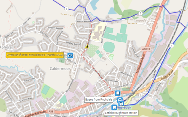
As the map below shows, the first detour – right at the start – involves following Hare Hill Road and then Calderbook Road from Littleborough town centre to join the route shortly after the 1.5-mile/2.5-km point:
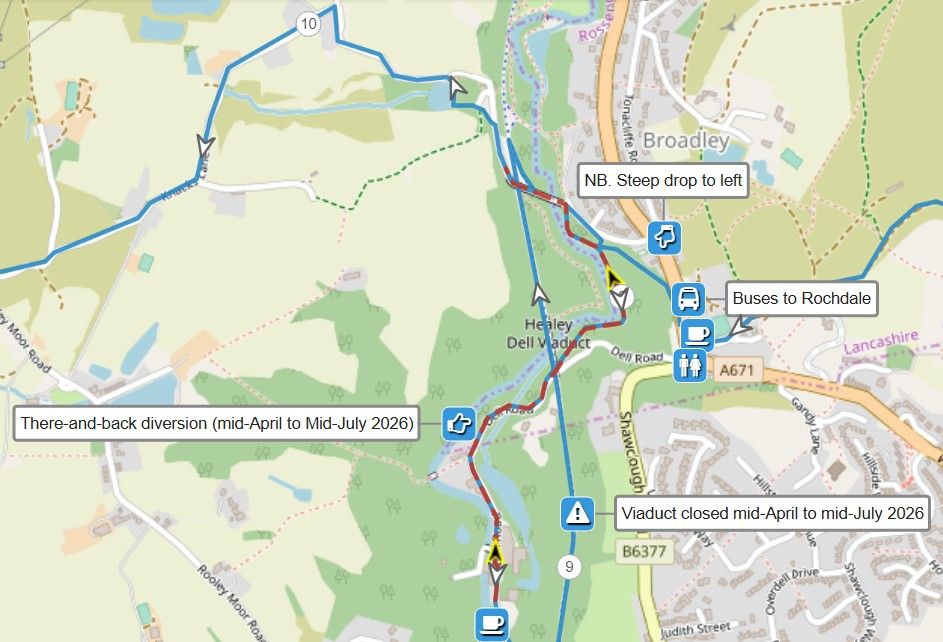
The second diversion is due to the temporary closure of the viaduct (for works) at Healey Dell, from mid-April to mid-July 2026. As the map below shows, simply follow the main route through the gorge as far as Healey Dell Tearooms and then retrace your steps to return to Station Road. There turn left along the road to soon rejoin the main route:
To give any feedback or notify us of any issues with this route, please complete this form.