Stage 1 uses towpaths, walkways, parkland and the Trans Pennine Trail to trace an almost totally traffic-free and tranquil route from the city centre to the verdant Mersey Valley.
Highlights include:
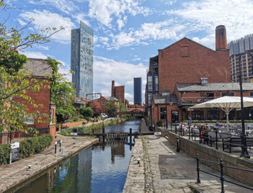
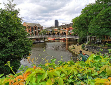
- The towpaths of the historic Rochdale and Bridgewater Canals
- Castlefield’s industrial and transport-related heritage
- Longford Park, with its petting zoo, cafe and play areas
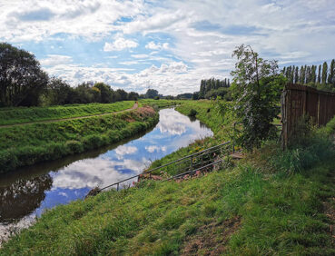
- Turn Moss, a lovely open area of grassland and trees.
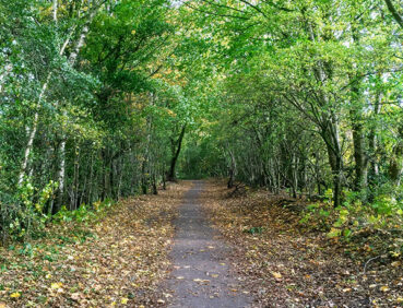
- Tree-lined paths and lanes in the Mersey Valley greenbelt.
Despite the name of the tram stop where the stage ends, Sale Water Park itself is visited on Stage 19 of the GM Ringway.
Note that parts of this walk – especially the short section across grass in Turn Moss – may be damp, muddy and slippery at any time of year and especially after periods of wet weather. Please bear this in mind when planning your trip.
Be sure to keep your dog on its lead in sensitive areas, which include upland areas such as moorland, wetlands and mosslands, farmland, and parkland. Keeping dogs on leads helps protect both livestock and wildlife, especially ground-nesting birds.
This walk is available on the user-friendly Go Jauntly walking app. Here, photographs and written directions will enable you to follow the route on your phone. You can also download a printable PDF of the directions from the same link.
Alternatively, you can follow the route (without written directions) on the mobile-friendly Plotaroute site. To use Plotaroute on your phone’s browser, simply click the map. Then, when you’re ready to start walking, click the tracker icon (bottom right) to show your position as you follow the route.
We recommend carrying an additional power source and/or map when following online routes on your phone. For any challenging routes, we would recommend that you also have access to and know how to read an Ordnance Survey map.
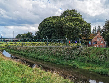
The route is almost entirely level, apart from some slight rises and gentle descents across side canals on the Bridgewater Canal and steps onto and off the footbridge at the 4.5-mile/7.2-km point. Most of the paths are either hard-surfaced – though cobbled in places – or well-made. The exception is the section across grass on Turn Moss (at the 5.5-mile/8.5-km point). There are also some narrow sections near locks and unfenced drops along the canal towpath. Mud and puddles are likely on certain sections, especially in and around Turn Moss.
You will need to watch out for bikes on the Bridgewater Canal sections in particular.
The paths and terrain encountered on this walk are shown and described on the Go Jauntly version of the walk, enabling you to make your own assessment of whether the route is accessible for you.
However, the varied terrain involved in this walk means that the overall route is not suitable for wheelchairs or pushchairs. Please visit our Shorter walks page for a selection of step-free walks on the GM Ringway trail. In addition, most of the paths in Longford Park, visited on this stage, are step-free and hard-surfaced.
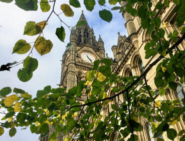
There are public toilets (including accessible facilities) in the Town Hall Extension on Mount Street near the start of the walk and – to the best of our knowledge – at Sale Water Park near the end of the route. In addition, there are a great many pubs and cafes in the city centre as well as bars and restaurants at Castlefield. The route passes Café Football (within Hotel Football) at the 2.5-mile/4.1-km point, which may, however, be very busy on match days. There is also a café (with toilets open to all) in Longford Park at the 4.8-mile/7.8 km point. Close to the end of the route you’ll find the Jackson’s Boat pub and the nearby Tree Tops café.
For an overview of locations, see the Plotaroute map.
Start and end points
To work out how to get to and from the walk start end points, simply click the links below to see the location in Google Maps. Then click ‘Directions’ and enter your starting location. For public transport options, click the train icon.
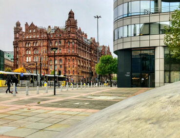
Start point: St Peter’s Square tram stop M2 5PD
End point: Sale Water Park tram stop M33 2LX
Alternatively, input the locations shown on this page into the TfGM journey planner.
As the GM Ringway is designed around the tram, train and bus network, we recommend the use of public transport to access the start and end points. However, we also provide tips for drivers below.
Public transport
This trail stage connects St Peter’s Square, served by Metrolink trams from across the network (and close to city centre bus and train terminals), with Sale Water Park tram station, on the city centre-to-airport line. Train times can be checked by visiting the National Rail website, while details of bus and tram services can be found on the TfGM journey planner.
Recommended tickets
If you are travelling only by tram, you will need a Metrolink ticket to cover the zones you travel through. You can check the price of these on the Bee Network website and then purchase your ticket from the machine at the stop or tap in and out with your bank card.
If you are travelling by a mix of buses, trains or trams, then a combined day ticket might be cheaper. Check the TfGM Tickets and passes page to find the best option (selecting ‘1 day and return’ as your answer to ‘How often would you be travelling?’).
Parking
Drivers are advised to park at Sale Water Park Metrolink Park & Ride (postcode M33 2LX), where there is parking for 285 cars (and 16 disabled spaces), and take the tram to St Peter’s Square. You will then return to your car at the end of the walk.
Cut-off points
If, for example, you only want to walk a section of the stage, you can most easily leave or access the route at one of the several Metrolink tram stops that are on or close to the route. These include Pomona and Stretford tram stops. For location details see the Plotaroute map.
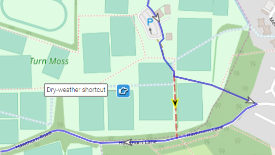
One optional shortcut is shown on the Plotaroute map. Suitable only after periods of dry weather, this involves cutting straight across the grass from just south of the Turn Moss car park to reach Hawthorn Lane. However, we have found that, in wet conditions, this route can be even more waterlogged than the main route described on the Go Jauntly app:
To give any feedback or notify us of any issues with this route, please complete this form.