This urban walk samples the Manchester and Salford city centre sections of the GM Ringway walking trail. The route connects an incredible number of historic sites via waterways and traffic-free spaces.
Highlights include:
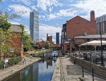
- The towpaths of the historic Rochdale and Bridgewater Canals
- Castlefield’s Roman remains and industrial heritage
- Paths by the wide River Irwell on its steady course between Manchester and Salford
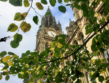
- Manchester’s Medieval Quarter, home to the city’s majestic cathedral and Chetham’s Library, the oldest public library in the English-speaking world
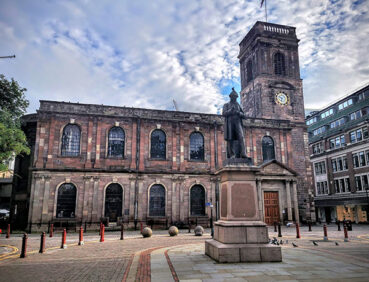
- The neoclassical St Ann’s Church, a Grade I-listed building
Note that parts of the trail may be damp and slippery at any time of year and especially after periods of wet weather. Please bear this in mind when planning your trip.
This walk is available on the user-friendly Go Jauntly walking app. Here, photographs and written directions will enable you to follow the route on your phone. You can also download a printable PDF of the directions from the same link.
Alternatively, you can follow the route (without written directions) on the mobile-friendly Plotaroute site. To use Plotaroute on your phone’s browser, simply click the map. Then, when you’re ready to start walking, click the tracker icon (bottom right) to show your position as you follow the route.
We recommend carrying an additional power source and/or map when following online routes on your phone. For any challenging routes, we would recommend that you also have access to and know how to read an Ordnance Survey map.
The route is almost entirely level, aside from a couple of short rises and descents along the Bridgewater Canal, where you will also need to watch out for bikes There are also some steps or slopes as you access or leave the waterside paths and use the bridges en route.
Furthermore, virtually all of the paths used are hard-surfaced, though there are some of the waterside paths have narrow, cobbled or uneven sections where you should pay attention to your footing.
The paths and terrain encountered on this walk are shown and described on the Go Jauntly version of the walk, enabling you to make your own assessment of whether the route is accessible for you.
Furthermore, all of this route from the 2-mile/3.2-km point (near Aviva Studios) is step-free and well surfaced. However, the varied terrain encountered before then means that the overall route is not suitable for wheelchairs or pushchairs. Please check out our other Shorter walks for a selection of totally step-free walks on the GM Ringway trail.
Free-of-charge public toilets (including accessible facilities) are passed in the Town Hall Extension in Mount Street, near the start and end point. Aside from that, you will pass a massive number bars, cafes and restaurants during your explorations of the city centre.
Getting there
As the GM Ringway is designed around the tram, train and bus network, we recommend the use of public transport to access the walk. However, we also provide tips for drivers below.
Start and end points
To work out how to get to and from the walk start and end point, simply click the link below to see the location in Google Maps. Then click ‘Directions’ and enter your starting location. For public transport options, click the train icon.
Start and end point: St Peter’s Square tram stop M2 5PD
Alternatively, input the location shown on this page into the TfGM journey planner.
Public transport
The walk starts and finishes in St Peter’s Square, served by Metrolink trams from across the network (and close to city centre bus and train terminals, as shown on the Plotaroute map). Details of bus and tram services can be found on the TfGM journey planner while train times can be checked by visiting the National Rail website.
Recommended tickets
If you are travelling only by tram, you will need a Metrolink ticket to cover the zones you travel through. You can check the price of these on the Bee Network website and then purchase your ticket from the machine at the stop or tap in and out with your bank card.
If you are travelling by a mix of buses, trains or trams, then a combined day ticket might be cheaper. Check the TfGM Tickets and passes page to find the best option (selecting ‘1 day and return’ as your answer to ‘How often would you be travelling?’).
Parking
To avoid driving to and parking in the busy city centre, you are advised to utilise one of the Park and Ride facilities spread across Greater Manchester. From any of these, you should be able to catch a direct tram, train or bus to the walk start point or a point nearby. For details, see the TfGM Park and Ride webpage.
We have no reports of any issues affecting this walk. Please let us know if you encounter any problems by completing this short form.