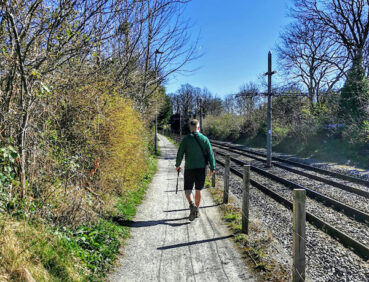
Stage 3 of the GM Ringway follows the pretty Ladybrook Valley that weaves through the suburbs of Stockport.
Please note the diversion west of Bramhall Park from March to late July 2026. See ‘Detours and trail updates’ below.
Highlights include:
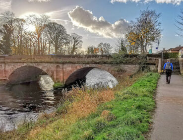
- A riverside and woodland route between Didsbury and Cheadle villages via Abney Hall Park with its waterfall and ponds
- The Grade I-listed St Mary’s Church in Cheadle, dating back to 1530
- Quiet paths along the tree-lined Micker Brook
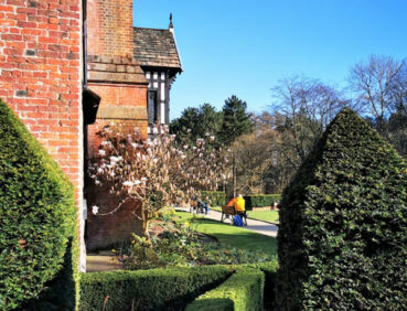
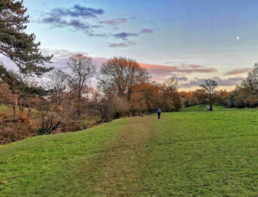
- The 70-acre Bramhall Park, with its woodland, ponds, play area and cafe
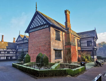
- Bramall Hall, a superb Tudor manor house (Grade I-listed)
- Carr Wood Local Nature Reserve, a beautiful area of semi-ancient woodland in a gorge-like valley.
Note that parts of the trail may be damp, muddy and slippery at any time of year and especially after periods of wet weather. Please bear this in mind when planning your trip.
Be sure to keep your dog on its lead in sensitive areas, which include upland areas such as moorland, wetlands and mosslands, farmland, and parkland. Keeping dogs on leads helps protect both livestock and wildlife, especially ground-nesting birds.
This walk is available on the user-friendly Go Jauntly walking app. Here, photographs and written directions will enable you to follow the route on your phone. You can also download a printable PDF of the directions from the same link.
Alternatively, you can follow the route (without written directions) on the mobile-friendly Plotaroute site. To use Plotaroute on your phone’s browser, simply click the map. Then, when you’re ready to start walking, click the tracker icon (bottom right) to show your position as you follow the route.
We recommend carrying an additional power source and/or map when following online routes on your phone. For any challenging routes, we would recommend that you also have access to and know how to read an Ordnance Survey map.
The great majority of the route is level, though there is a brief ascent, partly up steps, in Bramhall Park. The paths used are very mixed in quality. Much of the route uses pavements, hard-surfaced paths and well-made gravel paths. In contrast, the riverside sections south of Cheadle village and between Cheadle Viaduct and Bramhall Park can be very muddy and slippery, requiring care.
The paths and terrain encountered on this walk are shown and described on the Go Jauntly version of the walk, enabling you to make your own assessment of whether the route is accessible for you.
However, the varied terrain involved in this route means that the overall route is not suitable for wheelchairs or pushchairs. Please visit our Shorter walks page for a selection of step-free walks on the GM Ringway trail. These include a lovely step-free circuit around Bramhall, including part of Stage 3.
There are also hard-paved step-free paths within Abney Hall Park and Bramhall Park. In addition, the section of Stage 3, between Demmings Road and Ladybridge Road (the Ladybrook Valley Cycleway) is hard-paved and suitable for a wide range of users:
Public toilets, including accessible facilities, can be found by the Stables Kitchen café and visitor centre in Bramhall Park. In addition, there are plenty of cafes, pubs, shops and restaurants in Didsbury, Cheadle and Bramhall villages, and some other refreshment opportunities shown on the Plotaroute map.
Finally, there is a large children’s play area in Bramhall Park.
As the GM Ringway is designed around the tram, train and bus network, we recommend the use of public transport to access the start and end points. However, we also provide tips for drivers below.
Start and end points
To work out how to get to and from the walk start end points, simply click the links below to see the location in Google Maps. Then click ‘Directions’ and enter your starting location. For public transport options, click the train icon.
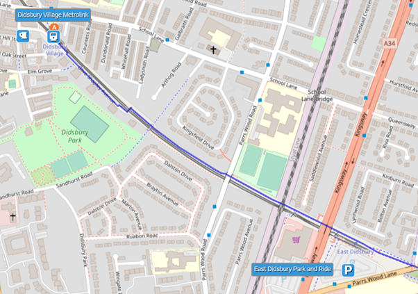
Start point: Didsbury Village tram stop M20 6WE
End point: Bramhall station SK7 2DU
Alternatively, input the locations shown on this page into the TfGM journey planner.
Public transport
This trail stage starts at Didsbury Village tram station on the Manchester-East Didsbury line. It ends at Bramhall station, served by trains from Manchester Piccadilly and Stockport.
Depending on your home location, you could:
- Travel by direct bus to the start point and from the end point (for example, from Stockport town centre);
- Take the tram to Didsbury Village and return home by train from Bramhall (for example from Manchester city centre);
- Travel only by train, using the train to East Didsbury train station, approximately 800 metres from the start point, and returning home from Bramhall station;
- Take the tram to Didsbury Village (or park nearby) and return by direct bus from Bramhall to Didsbury.
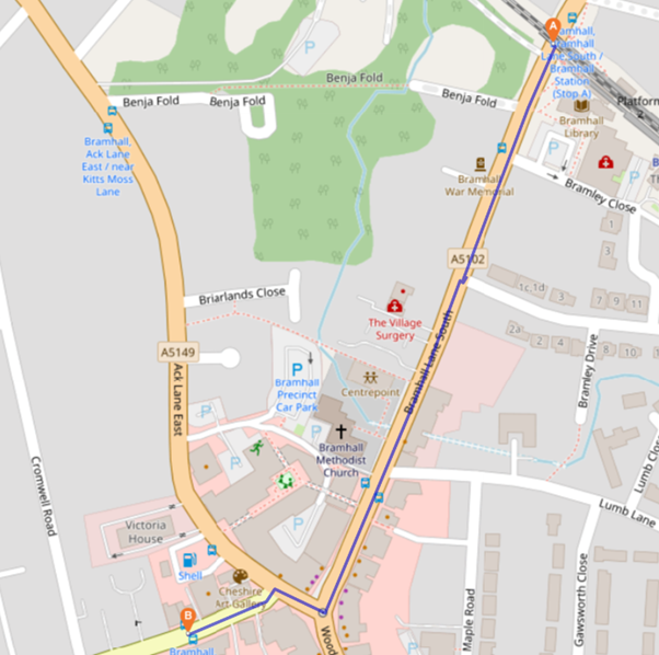
To reach the bus stop for the direct bus from Bramhall to Didsbury (the 42B, as of April 2024), head south from Bramhall station along Bramhall Lane South towards the village centre. After passing Costa Coffee on the left, turn right onto Ack Lane East and then immediately left onto Moss Lane, soon reaching the bus stop on the left. The 500-metre walk will take around 8 minutes:
Train times can be checked by visiting the National Rail website, while details of bus and tram services can be found on the TfGM journey planner.
Recommended tickets
For your tram journey, you will need a Metrolink ticket to cover the zones you travel through. You can check the price of these on the Bee Network website and then purchase your ticket from the machine at the stop or tap in and out with your bank card. You can check the price of a single train ticket to or from any train station on the National Rail website. Tickets can be purchased online or from the ticket office or machine at the station.
However, as you are likely to be travelling by a mix of trams and trains (and possibly buses), then a combined day ticket might be cheaper. Check the TfGM Tickets and passes page to find the best option (selecting ‘1 day and return’ as your answer to ‘How often would you be travelling?’).
If you are travelling only by train (to East Didsbury and from Bramhall), a Greater Manchester Rail Ranger may be cheaper. This can be used on any train (and trams within the city centre) all day on weekends and bank holidays at off-peak times on weekdays. For details, see this page.
If you are travelling only by bus, then buses within Greater Manchester cost £2 for a single ticket and £5 for an AnyBus ticket, valid for multiple bus journeys all day and obtainable from the driver (prices correct as of March 2024).
Parking
Drivers are advised to park at East Didsbury Metrolink Park & Ride, where there is parking for 278 cars with 19 disabled spaces. They can then start the walk from here (missing out the first 500 metres) or take the tram for one stop to the walk start at Didsbury Village tram stop.
At the end of the walk, they can return by direct bus from Bramhall (the 42B as of March 2024), to East Didsbury tram station/Parrs Wood. Tickets currently cost £2 for the 30-minute journey. To reach the bus stop from the walk finish point, see the map below or use Google Maps to reach the bus stop location.

Cut-off points
If, for example, you only want to walk a section of the stage, there are several locations where public transport can be used to leave or to access the route. These include bus stops in Cheadle Village at the 2.5-mile point and Ladybridge Road at the 5-mile point. For details, see the Plotaroute map.
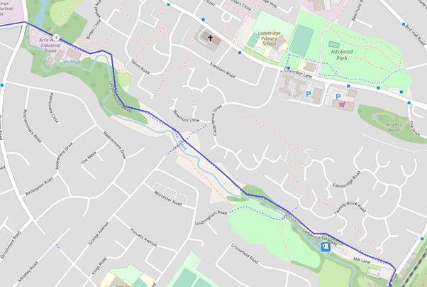
A a diversion in place along the Ladybrook Valley west of Bramhall Park due to path improvement works from March to late July 2026.
This is shown on the Plotaroute map, described on the Go Jauntly app and illustrated below:
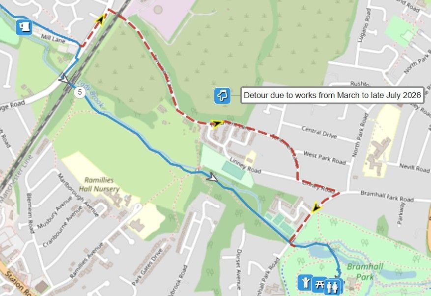
On reaching Ladybridge Road, turn left, cross with care, and take the next right, Tenement Lane. This becomes a tree-lined way in its central section. At the T-junction with Linney Lane, turn left and then sharp right onto Bramhall Park Lane. After crossing the river, turn left down the steps to rejoin the main route.
To give any feedback or notify us of any issues with this route, please complete this form.