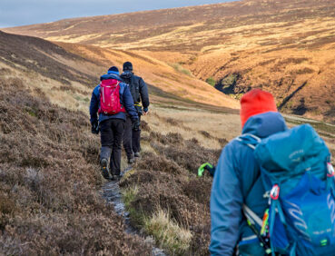
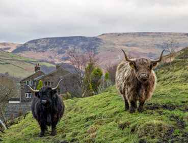
Stage 8 is an adventurous route that ventures high into the Dark Peak. With its spectacular scenery, it has a feel of the Scottish Highlands in places.
Despite the works on Chew Road advertised by United Utilities (during 2025-26), users have reported that this stage is fully walkable at weekends and outside working hours.
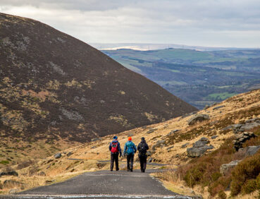
Note that the highest parts of this stage are challenging at all times and hazardous in adverse conditions. If the weather is poor, the walk should therefore only be undertaken by experienced hillwalkers with appropriate equipment, including a map and compass. Even in fine weather, you should be prepared for a considerable ascent (535 m/1755 ft) and a crossing of remote, boggy terrain with no landmarks for navigation and no clear path on the ground.
For an easier low-level alternative, with the option to break the stage into two shorter walks, you can access an alternative stage 8 route, with photos and step-by-step directions, on the Go Jauntly app. This is also shown as an optional diversion on the Plotaroute map.
Highlights include:
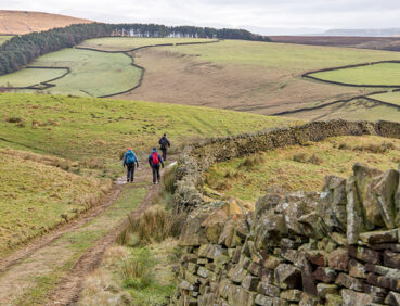
- Two lovely old lanes, with panoramic views across the Etherow and Longdendale valleys
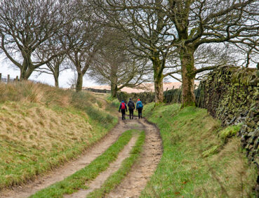
- An ancient-feeling track that climbs into the Peak District National Park via an old stone bridge
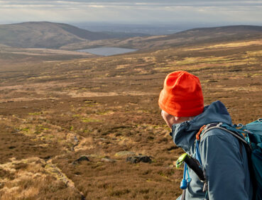
- A brief trackless section through the appropriately named ‘Wilderness’ – the highest point of the entire GM Ringway trail
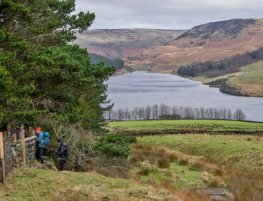
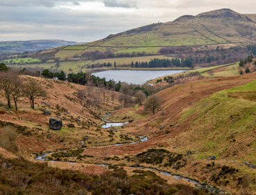
- Breathtaking views over Saddleworth’s Chew Valley
- A leisurely finish via Chew Piece Plantation, the only remaining area of long-standing deciduous woodland near Dove Stones Reservoir.
Note that parts of the trail may be damp, muddy and slippery at any time of year and especially after periods of wet weather. Please bear this in mind when planning your trip.
Be sure to keep your dog on its lead in sensitive areas, which include upland areas such as moorland, wetlands and mosslands, farmland, and parkland. Keeping dogs on leads helps protect both livestock and wildlife, especially ground-nesting birds.
This walk is available on the user-friendly Go Jauntly walking app. Here, photographs and written directions will enable you to follow the route on your phone. You can also download a printable PDF of the directions from the same link.
Alternatively, you can follow the route (without written directions) on the mobile-friendly Plotaroute site. To use Plotaroute on your phone’s browser, simply click the map. Then, when you’re ready to start walking, click the tracker icon (bottom right) to show your position as you follow the route.
We recommend carrying an additional power source and/or map when following online routes on your phone. For any challenging routes, we would recommend that you also have access to and know how to read an Ordnance Survey map.
The route includes a considerable ascent, steep in parts, to the highest point of the whole GM Ringway trail (at 500 m above sea level) and includes some rough, trackless terrain. The paths used vary greatly in quality, ranging from a tarmac-surfaced reservoir access road and unmade country lanes to grassy, sloping field paths and unclear tracks across boggy moorland. Mud and puddles are very likely on certain sections.
The paths and terrain encountered on this walk are shown and described on the Go Jauntly version of the walk, enabling you to make your own assessment of whether the route is accessible for you.
However, the varied terrain involved in this route means that the overall route is not suitable for wheelchairs or pushchairs. Please visit our Shorter walks page for a selection of step-free walks on the GM Ringway trail.
There are no public toilets or other facilities on the main part of the route, but there is a cafe and farm shop with toilets 0.5 miles / 800 m to the southeast of the start point at Lymefield garden centre. There are also pubs, a shop and a café close to the 3-mile (5-km) point in Hollingworth, a short way east along the A57. There are also pubs and café at the end of the walk in Greenfield. For location details, see the Plotaroute map.
As the GM Ringway is designed around the tram, train and bus network, we recommend the use of public transport to access the start and end points. However, we also provide tips for drivers below.
Start and end points
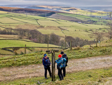
To work out how to get to and from the walk start end points, simply click the links below to see the location in Google Maps. Then click ‘Directions’ and enter your starting location. For public transport options, click the train icon.
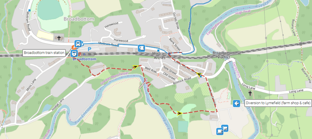
Start point: Broadbottom station SK14 6AX
End point: Greenfield station OL3 7JZ
Alternatively, input the locations shown on this page into the TfGM journey planner.
Public transport
This trail stage connects Broadbottom and Greenfield stations, both served by trains 7 days a week from Manchester. While Greenfield has frequent bus services from Oldham and Manchester, buses from Broadbottom (to Hyde and Glossop) run only on Monday to Saturday daytimes and do not provide any advantage. For this reason, unless you are returning from Greenfield to the Oldham or Rochdale areas by bus, we recommend using trains for both parts of the journey.
Train times can be checked by visiting the National Rail website, while details of bus and tram services can be found on the TfGM journey planner.
Recommended tickets
If you are travelling only by train from locations within Greater Manchester, you can purchase single tickets from your nearest station to Broadbottom and from Greenfield You can check the price of these on the National Rail website. Tickets can be purchased online or from the ticket office or machine at the station.
Depending on your starting location, a Greater Manchester Rail Ranger may be cheaper. This can be used on any train (and trams within the city centre) all day on weekends and bank holidays at off-peak times on weekdays. For details, see this page.
If you are travelling by a mix of trains, buses or trams, then a combined day ticket might be cheaper. Check the TfGM Tickets and passes page to find the best option (selecting ‘1 day and return’ as your answer to ‘How often would you be travelling?’).
Parking
As the start and end points are on different train lines, drivers are advised to park at their local station and travel by train to Marple and from Broadbottom. See ‘Public transport’ above.
Otherwise, for an early start, the best option is to park at Broadbottom station, where there is parking for 53 vehicles. At the end of the walk, you can then return to Broadbottom by train, changing at Manchester Piccadilly on a single ticket (Greenfield – Broadbottom). To check times and prices, visit the National Rail website.
Cut-off points
After the 2-mile (3.2-km) point where the route crosses the main A57 road (with buses to Ashton-under-Lyne and Glossop), there are no suitable points where the walk can be shortened using public transport. For this reason, be sure that you are equipped to complete the entire walk and that visibility is good.
Alternatively, follow the lower-level alternative route, shown as a diversion on the Plotaroute map, and available on the Go Jauntly app. This route can be divided into by walking down to Carrbrook, west of Brushes reservoir, and using the 343 bus route to and from Oldham, Hyde and Manchester.
For an easier low-level alternative avoiding the high, potentially hazardous moorland section and the closure of Chew Road on weekdays (2025-26), you can utilise our Stage 8 alternative route. This is shown on the map below, and described with photos and step-by-step directions, on the Go Jauntly app. It is also shown as an optional diversion on the Plotaroute map. 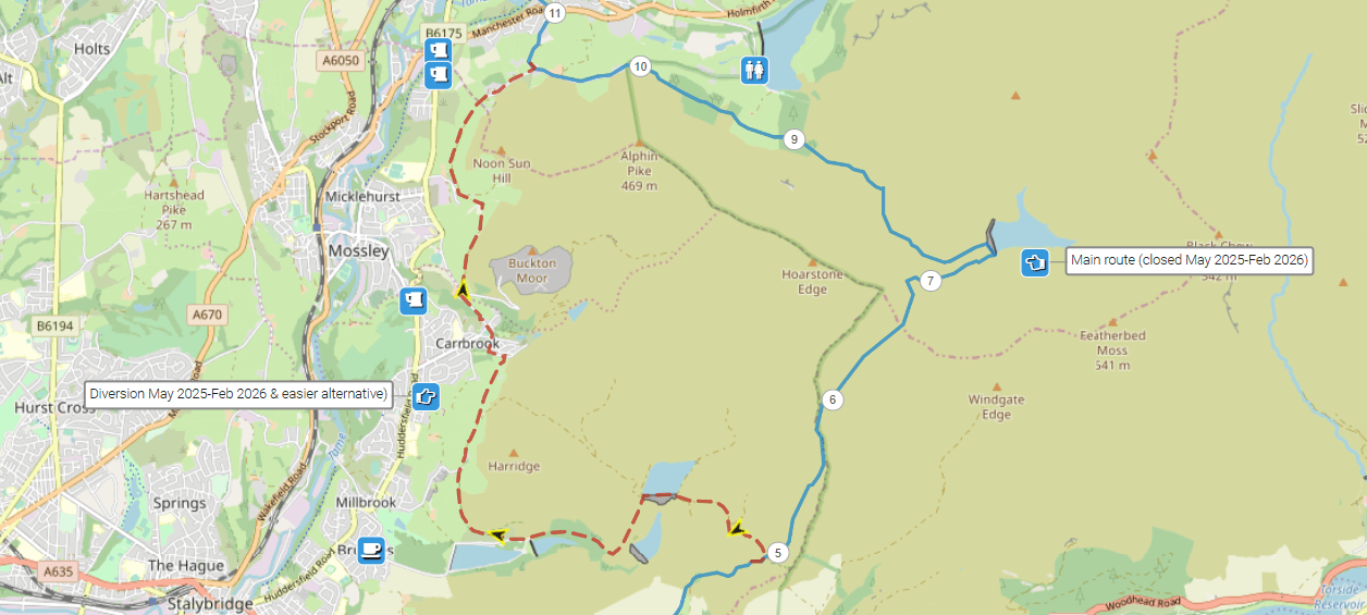
Another optional detour provides the option of starting the walk with a visit to Lymefield garden centre, where a café and toilets are available. This adds just over 0.5 miles / 800 metres to the walk.
To give any feedback or notify us of any issues with this route, please complete this form.
Peak & Northern Footpaths Society (PNFS) is a members-driven charity committed to protecting the rights of users of rights of way and public access land.
PNFS erects and maintains its own distinctive signposts and you can see three of these on Stage 8 at:
*Hobson Moor Road PNFS’s map location and grid reference
*Hollingworth Hall farm PNFS’s map location and grid reference
*Above Chew Brook PNFS’s map location and grid reference
PNFS are working closely with the GM Ringway to help respond to problems that you may encounter with the trail condition, including reporting issues to the relevant local authority.
To read more about PNFS visit their website at https://peakandnorthern.org.uk/ and for any issues relating to the trail condition, we would recommend you contact PNFS directly either by using the Path Checker app or via the PNFS website: Peak & Northern Footpaths Society – Report a problem (or Lost Way) (peakandnorthern.org.uk).