Hillier than the preceding stages of the GM Ringway, Stage 6 connects the train stations at Strines and Marple via a fantastic mix of scenic and heritage sites.
Highlights include:
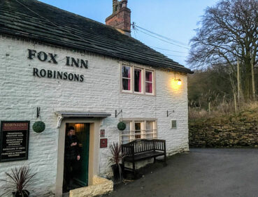
- The hamlet of Brook Bottom with its traditional country pub
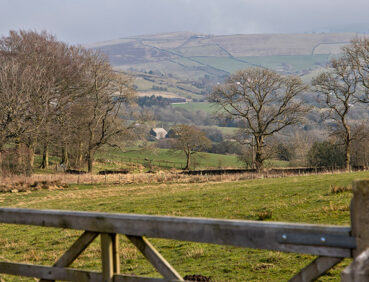
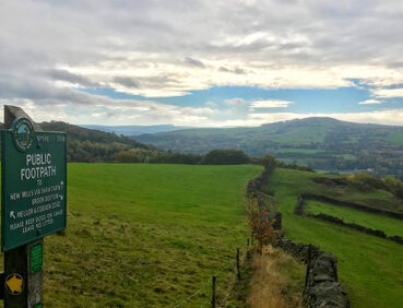
- An exploration of Mellor Moor, a high plateau offering stunning views, with one of the two highest summits in Stockport borough
- Mellor village, with its Iron Age archaeological site and church with the oldest wooden pulpit in England
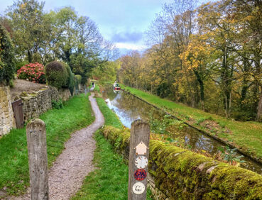
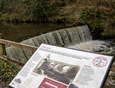
- The ‘Roman Lakes’, a Victorian beauty spot in the picturesque Goyt Valley
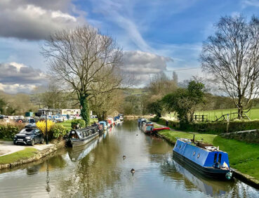
- The famous flight of locks at Marple.
Note that parts of the trail may be damp, muddy and slippery at any time of year and especially after periods of wet weather. Please bear this in mind when planning your trip.
Be sure to keep your dog on its lead in sensitive areas, which include upland areas such as moorland, wetlands and mosslands, farmland, and parkland. Keeping dogs on leads helps protect both livestock and wildlife, especially ground-nesting birds.
This walk is available on the user-friendly Go Jauntly walking app. Here, photographs and written directions will enable you to follow the route on your phone. You can also download a printable PDF of the directions from the same link.
Alternatively, you can follow the route (without written directions) on the mobile-friendly Plotaroute site. To use Plotaroute on your phone’s browser, simply click the map. Then, when you’re ready to start walking, click the tracker icon (bottom right) to show your position as you follow the route.
We recommend carrying an additional power source and/or map when following online routes on your phone. For any challenging routes, we would recommend that you also have access to and know how to read an Ordnance Survey map.
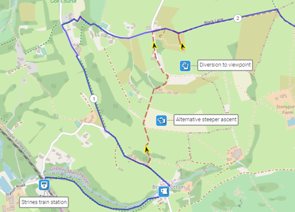
There are two fairly steep ascents, notably the final part of the ascent to Mellor Moor, and the climb, largely up steps, after crossing the ‘Roman Bridge’ across the River Goyt. Apart from that, most paths are level or downhill.
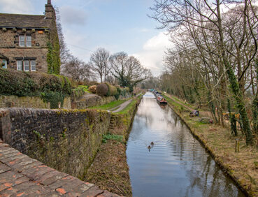
The quality and type of paths used are very mixed, including roadside pavements, canal towpaths, earthen paths, cobbled roads, and potholed country lanes. Mud and puddles are likely on certain sections.
The paths and terrain encountered on this walk are shown and described on the Go Jauntly version of the walk, enabling you to make your own assessment of whether the route is accessible for you.
However, the varied terrain involved in this route means that the overall route is not suitable for wheelchairs or pushchairs. Please visit our Shorter walks page for a selection of step-free walks on the GM Ringway trail.
There are no public toilets along the route, but there are pubs at Strines, Brook Bottom and Mellor village as well as several pubs and cafes in Marple Bridge close to Marple station. These are shown on the Plotaroute map.
As the GM Ringway is designed around the tram, train and bus network, we recommend the use of public transport to access the start and end points. However, we also provide tips for drivers below.
Start and end points
To work out how to get to and from the walk start end points, simply click the links below to see the location in Google Maps. Then click ‘Directions’ and enter your starting location. For public transport options, click the train icon.
Start point: Strines station SK22 3AL
End point: Marple station SK6 7DA
Alternatively, input the locations shown on this page into the TfGM journey planner.
Public transport
This trail stage connects Strines and Marple stations, both served by trains 7 days a week on the Manchester Piccadilly – New Mills line (but with no services from Stockport). Train times can be checked by visiting the National Rail website, while details of bus and tram services can be found on the TfGM journey planner.
If you’re based in Stockport, regular buses run from the town centre to stops near the start and end points. These are shown on the Plotaroute map.
Recommended tickets
If you are travelling only by train from locations within Greater Manchester, then a return ticket from your home location to Strines may be the best option. As Strines is further out from Manchester than Marple, you can use this ticket on your return journey. You can check the price of your ticket on the National Rail website. Tickets can be purchased online or from the ticket office or machine at the station.
Depending on your starting location, you should check if a Greater Manchester Rail Ranger may be cheaper (cost £8.20 as of March 2024). This can be used on any train (and trams within the city centre) all day on weekends and bank holidays at off-peak times on weekdays. For details, see this page.
If you are travelling only by bus, buses within Greater Manchester cost £2 for a single ticket and £5 for an AnyBus ticket, valid for multiple bus journeys all day and obtainable from the driver (prices correct as of March 2024).
If you are travelling by a mix of buses, trains or trams, then a combined day ticket might be cheaper. Check the TfGM Tickets and passes page to find the best option (selecting ‘1 day and return’ as your answer to ‘How often would you be travelling?’).
Parking
Drivers are advised to park at Marple station, where there is a large car park Then take the first train or bus for the short journey to Strines, and collect their car at the end of the walk. Train times can be checked by visiting the National Rail website, while details of bus and tram services can be found on the TfGM journey planner.
Cut-off points
If, for example, you only want to walk a section of the stage, the only location where you leave to access the route is in Mellor village, at the 5-mile/8-km point. From here buses run to Marple and Stockport, though there are no services on Sundays. For details, see the Plotaroute map.
Two optional diversions are shown on the Plotaroute map. The first consists of an alternative steeper ascent to Mellor Moor via Marple Cross, while the second involves a brief detour to the trig point for fabulous 360-degree views.
To give any feedback or notify us of any issues with this route, please complete this form.