This walk takes you from the leafy suburbs into open countryside and features lovely riverside scenery. Note that the first 1.5 miles / 2.2 km of this stage – through lovely Carr Wood and Bramhall Park – overlap with the final section of the previous stage.
Highlights include:
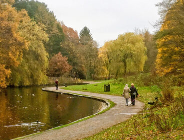
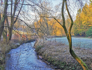
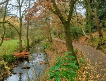
- Carr Wood, a beautiful area of semi-ancient woodland in a gorge-like valley
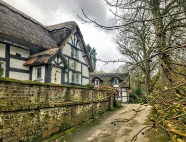
- Bramall Hall, a superb Tudor manor house (Grade I-listed)
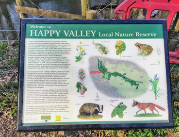
- Happy Valley, the first of Stockport’s local nature reserves
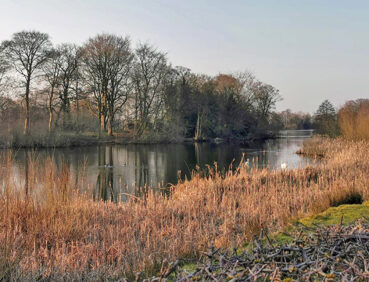
- The shores of pretty Poynton Pool within the 21-hectare Poynton Park
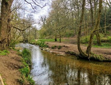
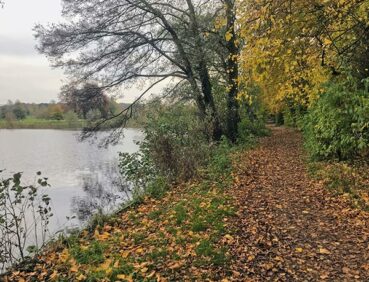
- The little-known jungle-like valley of Norbury Hollow.
Note that parts of the trail may be damp, muddy and slippery at any time of year and especially after periods of wet weather. Please bear this in mind when planning your trip.
Also bear in mind that trains serve the end point, the remote Middlewood Station, only every two hours for much of the week. See ‘Getting there’, below, for details of how to access more frequent buses to Stockport if no train is due.
Be sure to keep your dog on its lead in sensitive areas, which include upland areas such as moorland, wetlands and mosslands, farmland, and parkland. Keeping dogs on leads helps protect both livestock and wildlife, especially ground-nesting birds.
This walk is available on the user-friendly Go Jauntly walking app. Here, photographs and written directions will enable you to follow the route on your phone. You can also download a printable PDF of the directions from the same link.
Alternatively, you can follow the route (without written directions) on the mobile-friendly Plotaroute site. To use Plotaroute on your phone’s browser, simply click the map. Then, when you’re ready to start walking, click the tracker icon (bottom right) to show your position as you follow the route.
We recommend carrying an additional power source and/or map when following online routes on your phone. For any challenging routes, we would recommend that you also have access to and know how to read an Ordnance Survey map.
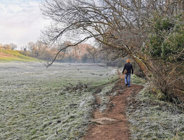
The majority of the route is level, though there is a brief descent, partly down steps, in Bramhall Park. The paths used are of mixed quality. While the first 2 miles (3.3 km) are on hard-surfaced paths, some of riverside and farmland sections can be muddy and slippery, requiring care. Walkers need to take special care when crossing London Road North (just before Poynton Park) and walking along two roads without pavements. These are the Chester Road/Woodford Road south of Hazel Grove and Middlewood Road at the end of the route.
The paths and terrain encountered on this walk are shown and described on the Go Jauntly version of the walk, enabling you to make your own assessment of whether the route is accessible for you.
There are several step-free paths within Bramhall Park and Poynton Park on this stage. However, the varied terrain involved in this route means that the overall route is not suitable for wheelchairs or pushchairs. Please visit our Shorter walks page for a selection of step-free walks on the GM Ringway trail.
Public toilets, including accessible facilities, can be found by the Stables Kitchen café and visitor centre in Bramhall Park. However, after the first 1.5 miles (2.3 km), there are no further toilet or refreshment facilities with daytime opening hours directly on the route.
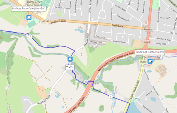
However, on Mondays to Saturdays, Norbury Farm Café in Hazel Grove is open just north of the 3-mile point. A little further on, a walk of approx. 500 metres will bring you to Brookside Garden Centre, which has a café and toilets and is open seven days a week:
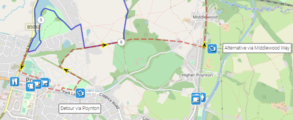
For a wider range of facilities, the Plotaroute map shows an alternative route via Poynton village centre. At the end of the route, there are pubs and cafes available at Nelson Pit, 0.5 miles (800 m) south along the Middlewood Way or a similar distance north in High Lane village.
As the GM Ringway is designed around the tram, train and bus network, we recommend the use of public transport to access the start and end points. However, we also provide tips for drivers below.
Start and end points
To work out how to get to and from the walk start end points, simply click the links below to see the location in Google Maps. Then click ‘Directions’ and enter your starting location. For public transport options, click the train icon.
Start point: Bramhall station SK7 2DU
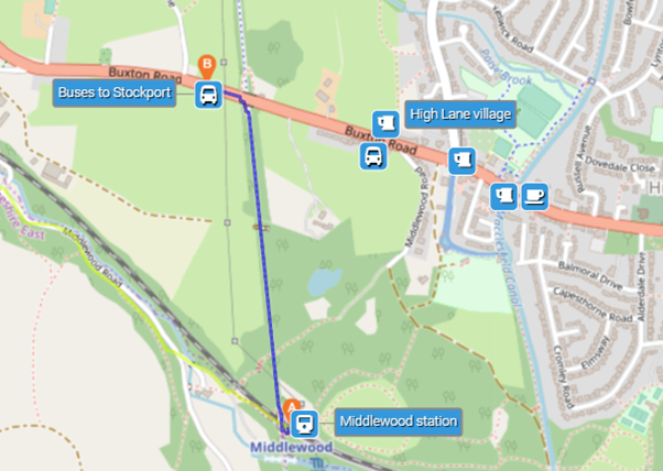
End point: Middlewood station SK12 1UA
Alternatively, input the locations shown on this page into the TfGM journey planner.
Public transport
This trail stage connects Bramhall station with Middlewood station, both served by direct trains from Stockport and Manchester. However, services can be infrequent especially on Sundays, particularly from the Middlewood. Bramhall is served by frequent buses from many locations. At the end of the walk, if there are no trains due from the remote Middlewood station, you may prefer to catch a bus by walking 0.5 miles (800 metres) north along the multi-user Middlewood Way. This will bring you to the main A6 road west of High Lane village, from where frequent buses run to Stockport town centre and refreshment options are available.
Train times can be checked by visiting the National Rail website, while details of bus and tram services can be found on the TfGM journey planner.
Recommended tickets
If you are travelling only by train from locations within Greater Manchester, you can purchase single tickets from your starting location to Bramhall and from Middlewood. You can check the price of these on the National Rail website. Tickets can be purchased online or from the ticket office or machine at the station.
Depending on your starting location, a Greater Manchester Rail Ranger may be cheaper. This can be used on any train (and trams within the city centre) all day on weekends and bank holidays and at off-peak times on weekdays. For details, see this page.
If you are travelling by a mix of trains, buses or trams, then a combined day ticket might be cheaper. Check the TfGM Tickets and passes page to find the best option (selecting ‘1 day and return’ as your answer to ‘How often would you be travelling?’).
Parking
As the start and end points are on different train lines, drivers are advised to park at their local station and travel by train to Bramhall and from Middlewood. See ‘Public transport’ above.
Otherwise, the best option is to park in Stockport town centre. Multiple car parks are available, with many detailed on the Stockport Council website. From the town centre, you can take a train or bus to Bramhall station to start the walk. Check the best option on Google Maps. After the end of the walk, return from Middlewood either by train or by walking 500 m to the main A6 west of High Lane, from where frequent buses run to Stockport, as shown on the map under ‘Public transport’ above.
Cut-off points
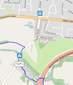
If, for example, you only want to walk part of this stage, the most straightforward access point is at the 3.5-mile point on the Chester Road south of Hazel Grove. The junction of Chester Road and Jacksons Lane is served by buses to Stockport and Hazel Grove and, less regularly, to Bramhall:
For further details, see the Plotaroute map.
Three optional diversions are shown on the Plotaroute map.
The first involves a detour into Poynton village centre for those seeking a wider range of facilities in the second half of the walk. The second, useful in very wet conditions, involves a continuation straight ahead along the path known as Prince’s Incline before turning north along the multi-user Middlewood Way towards Middlewood station. These are shown here:
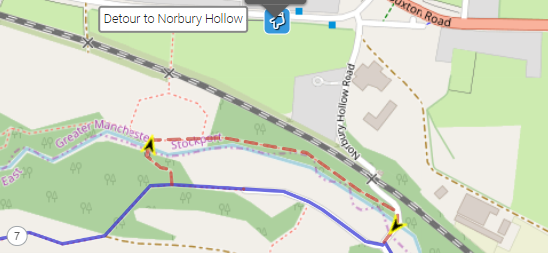
The third optional detour consists of a short loop via the wildest part of Norbury Hollow, where paths are narrow and often slippery:
To give any feedback or notify us of any issues with this route, please complete this form.
Peak & Northern Footpaths Society (PNFS) is a members-driven charity committed to protecting the rights of users of rights of way and public access land.
PNFS erects and maintains its own distinctive signposts and you can see one of these on Stage 4 at:
Parkgate Farm (fingerpost): PNFS’s map location and grid reference
PNFS are working closely with the GM Ringway to help respond to problems that you may encounter with the trail condition, including reporting issues to the relevant local authority.
To read more about PNFS visit their website at https://peakandnorthern.org.uk/ and for any issues relating to the trail condition, we would recommend you contact PNFS directly either by using the Path Checker app or via the PNFS website: Peak & Northern Footpaths Society – Report a problem (or Lost Way) (peakandnorthern.org.uk).