Overview
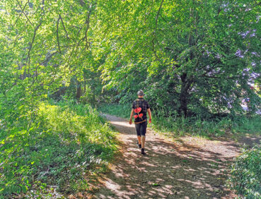
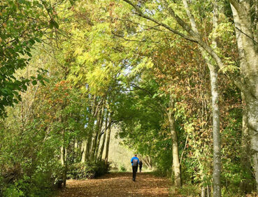
This varied route uses mainly traffic-free pathways to explore the waterways, parks and nature reserves of Altrincham and Sale.
Highlights include:
- Quiet paths and byways that give a flavour of Altrincham’s past as a Cheshire market town
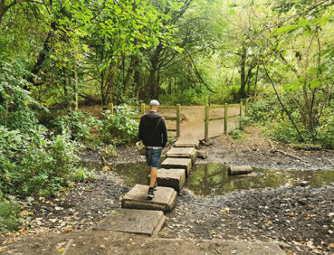
- A little-known nature reserve off the Bridgewater Canal, with ponds and woodland
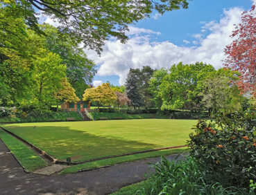
- Worthington Park and Priory Gardens, havens of greenery close to Sale town centre
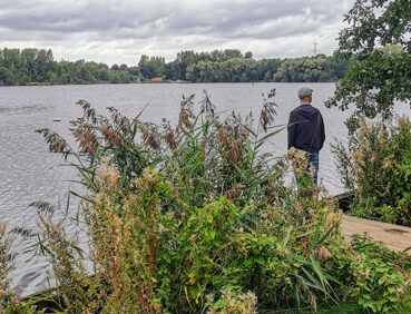
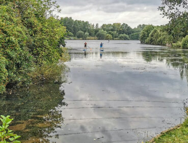
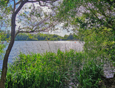
- The shores of Sale Water Park, with its sailing boats and views over Broad Ees Dole nature reserve, rich in birdlife
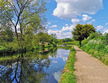
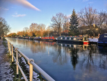
- A surprisingly quiet section of the canal south of Stretford town centre, where the passing boats create a colourful scene.
Note that parts of the trail may be damp, muddy and slippery at any time of year and especially after periods of wet weather. Please bear this in mind when planning your trip.
Be sure to keep your dog on its lead in sensitive areas, which include upland areas such as moorland, wetlands and mosslands, farmland, and parkland. Keeping dogs on leads helps protect both livestock and wildlife, especially ground-nesting birds.
Map & directions
This walk is available on the user-friendly Go Jauntly walking app. Here, photographs and written directions will enable you to follow the route on your phone. You can also download a printable PDF of the directions from the same link.
Alternatively, you can follow the route (without written directions) on the mobile-friendly Plotaroute site. To use Plotaroute on your phone’s browser, simply click the map. Then, when you’re ready to start walking, click the tracker icon (bottom right) to show your position as you follow the route.
We recommend carrying an additional power source and/or map when following online routes on your phone. For any challenging routes, we would recommend that you also have access to and know how to read an Ordnance Survey map.
Terrain
The entire route is very level. While majority of paths are wide and well made, you might encounter mud and puddles on certain sections. You will need to watch out for bikes on the Bridgewater Canal sections in particular.
Accessibility and facilities
The paths and terrain encountered on this walk are shown and described on the Go Jauntly version of the walk, enabling you to make your own assessment of whether the route is accessible for you.
However, the varied terrain involved in this route means that the overall route is not suitable for wheelchairs or pushchairs. Please visit our Shorter walks page for a selection of step-free walks on the GM Ringway trail. These include a step-free walk around Sale Water Park, featured on this stage. Much of the Bridgewater Canal towpath and the paths within the various parks en route are also step-free and suitable for all users.
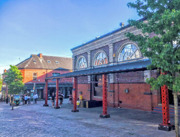
Payable public toilets (including accessible facilities) can be found in Altrincham Interchange at the start of this stage. The route passes others in Altrincham Market Hall, and a little later (also with accessible facilities) in John Leigh Park. Further along the way, there are toilets in Walton Park and in Sale Water Park. However, we have found that toilet availability in parks cannot be guaranteed. Toilets open to the public can also be found in Sale Waterside arts centre at the 5.5-mile/9-km point. At the end of the walk, payable public toilets (including accessible facilities) are available in Stretford Mall during opening hours.
There are ample refreshment opportunities on this stage of trail in Altrincham, Sale and Stretford centres and at a number of pubs and cafes en route. For location details, see the Plotaroute map.
Getting there
As the GM Ringway is designed around the tram, train and bus network, we recommend the use of public transport to access the start and end points. However, we also provide tips for drivers below.
Start and end points
To work out how to get to and from the walk start end points, simply click the links below to see the location in Google Maps. Then click ‘Directions’ and enter your starting location. For public transport options, click the train icon.
Start point: Altrincham Interchange WA14 1BL
End point: Stretford tram stop M32 8HN
Alternatively, input the locations shown on this page into the TfGM journey planner.
Public transport
This trail stage connects Altrincham Interchange, served by Metrolink trams from Manchester and elsewhere, trains from Manchester and Stockport, and buses from various locations, with Stretford tram stop, served by Metrolink trams from Altrincham and Manchester, and with several bus services nearby. Train times can be checked by visiting the National Rail website, while details of bus and tram services can be found on the TfGM journey planner.
Recommended tickets
If you are travelling only by tram, you will need a Metrolink ticket to cover the zones you travel through. You can check the price of these on the Bee Network website and then purchase your ticket from the machine at the stop or tap in and out with your bank card.
If you are travelling by a mix of buses, trains or trams, then a combined day ticket might be cheaper. Check the TfGM Tickets and passes page to find the best option (selecting ‘1 day and return’ as your answer to ‘How often would you be travelling?’).
Parking
Drivers are advised to park near the finish point at Stretford Metrolink Park & Ride (postcode M32 8HW), where there is parking for 35 vehicles (and 2 disabled spaces). From here they can take the tram for the 15-minute journey to the starting point in Altrincham.
An equally good alternative is to park halfway between Altrincham and Sale at Brooklands Metrolink Park & Ride (postcode M33 3SS), where there is parking for 84 vehicles (but with no disabled spaces). From here, it’s a short tram ride to Altrincham to start the walk and, later, back from Stretford at the end of the walk.
Car parks near the start of the walk in Altrincham are listed on the Trafford Council website. These include Oakfield Road car park (postcode WA15 8EW), with 300 spaces and 12 disabled spaces.
Note that car parks may fill up quickly on days when Manchester United is playing or at other busy times.
Cut-off points
If, for example, you only want to walk a section of the stage, you can most easily leave or access the route at one of the several Metrolink tram stops that are on or close to the route. These include Timperley, Brooklands, Sale, and Sale Water Park. For location details, see the Plotaroute map.
Detours and trail updates
Two diversions are shown on the Plotaroute map.
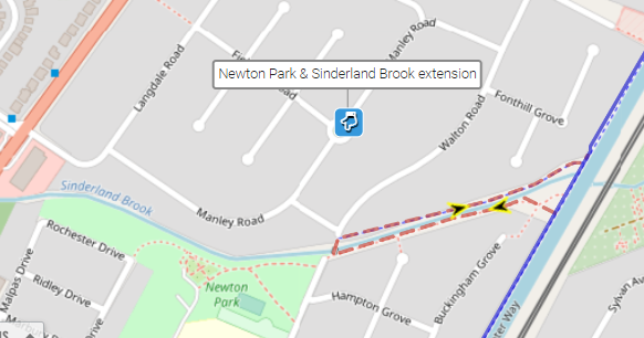
The first, at the 4-mile/6.5-km point, is an optional 500-metre extension along paths either side of Sinderland Brook. These give access to pretty Newton Park, where picnic tables are available:
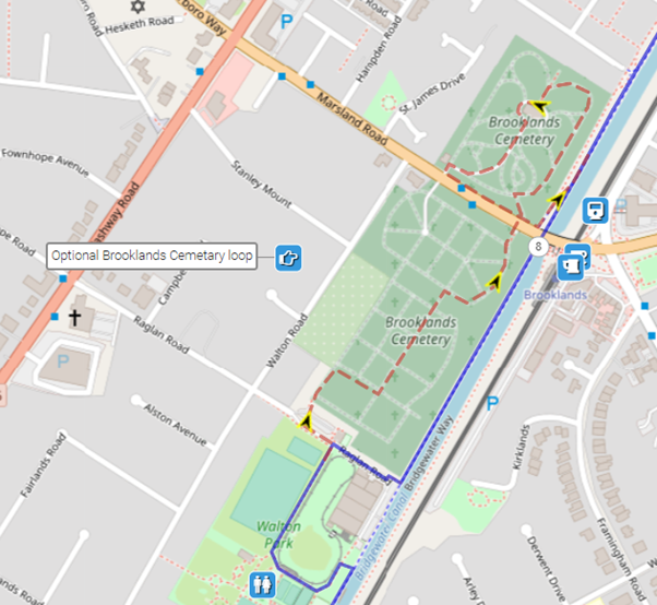
The second is an optional loop (which adds 600 metres to the overall distance) around the attractive Brooklands Cemetery. Here, you can see the graves of the famous scientist J P Joule and other luminaries:
To give any feedback or notify us of any issues with this route, please complete this form.