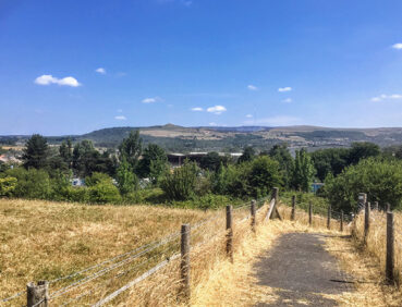
Gentler and shorter than the previous stages of the trail, this varied route includes a lovely mix of pastureland, waterways and woodland.
Highlights include:
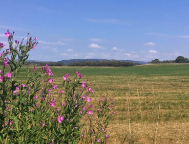
- The view towards Winter Hill from the hilltop village of Blackrod
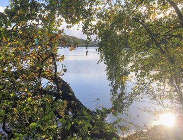
- Worthington Lakes, a chain of unusually picturesque reservoirs
- Haigh Hall and the surrounding Haigh Woodland Park, with its wildlife-rich forest plantations
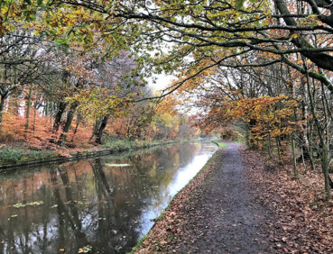
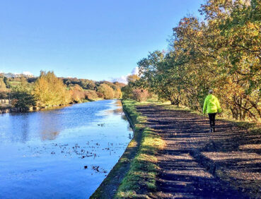
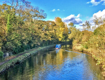
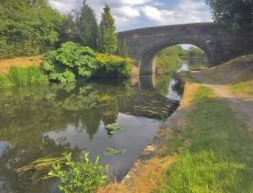
- Picturesque sections of the Leeds and Liverpool Canal
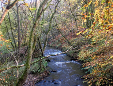
- A delightful finish, following the River Douglas all the way into Wigan town centre.
Note that parts of the trail may be damp, muddy and slippery at any time of year and especially after periods of wet weather. Please bear this in mind when planning your trip.
Be sure to keep your dog on its lead in sensitive areas, which include upland areas such as moorland, wetlands and mosslands, farmland, and parkland. Keeping dogs on leads helps protect both livestock and wildlife, especially ground-nesting birds.
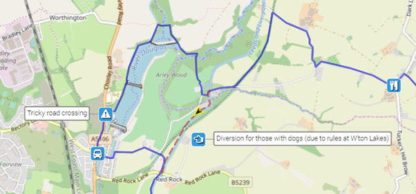
Please note that the circuit of Worthington Lakes is not open to walkers with dogs. For them, an alternative canal-side route is described in ‘Detours and trail updates’ below.
This walk is available on the user-friendly Go Jauntly walking app. Here, photographs and written directions will enable you to follow the route on your phone. You can also download a printable PDF of the directions from the same link.
Alternatively, you can follow the route (without written directions) on the mobile-friendly Plotaroute site. To use Plotaroute on your phone’s browser, simply click the map. Then, when you’re ready to start walking, click the tracker icon (bottom right) to show your position as you follow the route.
We recommend carrying an additional power source and/or map when following online routes on your phone. For any challenging routes, we would recommend that you also have access to and know how to read an Ordnance Survey map.
The gradients on this walk are gentle, especially compared with the preceding, much hillier stages of the trail. There a brief ascent at the start from Blackrod station to the village, and another later from the canal to Haigh Woodland Park. Otherwise, most of the paths are level or gently descending.
Paths are generally of good quality apart from the brief section across fields and paddocks south of Blackrod – where some stiles may be encountered – and the descent into Arley Wood just before Worthington Lakes. Some of the route follows quiet roads without pavements. Proceed with care on these sections. Also take care on crossing the busy Chorley Road after exiting the Worthington Lakes car park.
Very occasionally, at the 8.5-mile/14-km point, the riverside path at the southern end of Haigh Plantations may be flooded. If this appears to be the case, please follow the diversion via Wigan Road detailed in ‘Detours and trail updates’ below.
Mud and puddles are likely on certain sections.
The paths and terrain encountered on this walk are shown and described on the Go Jauntly version of the walk, enabling you to make your own assessment of whether the route is accessible for you.
However, the varied terrain involved in this route means that the overall route is not suitable for wheelchairs or pushchairs. In addition, all pathways in the upper side of Haigh Woodland Park are accessible for wheelchair users, according to the park website. Please visit our Shorter walks page for a selection of other step-free walks on the GM Ringway trail.
There are public toilets, including accessible facilities at the 6.5-mile/11-km point in Haigh Woodland Park and at the end of the walk in the Grand Arcade shopping centre in Wigan town centre. Finally, the toilets in Wigan North Western station can be accessed even by those without rail tickets.
Refreshment opportunities can be found in three locations. These are Blackrod, where there are pubs and a useful shop, Haigh Woodland Park where there is a variety of food and drink outlets in the ‘Kitchen Courtyard’, and Wigan town centre, with its pubs, cafes and restaurants. For location details, see the Plotaroute map.
As the GM Ringway is designed around the tram, train and bus network, we recommend the use of public transport to access the start and end points. However, we also provide tips for drivers below.
Start and end points
To work out how to get to and from the walk start end points, simply click the links below to see the location in Google Maps. Then click ‘Directions’ and enter your starting location. For public transport options, click the train icon.
Start point: Blackrod station BL6 5JH
End point: Wigan Wallgate station WN1 1BB
Alternatively, input the locations shown on this page into the TfGM journey planner.
Public transport
This trail stage connects Blackrod station, served by trains from Manchester and Bolton, with Wigan, where there are two train stations only 100 m apart. Both of these – Wigan Wallgate and Wigan North Western – are served by direct trains to Manchester, Bolton and other destinations. Buses also connect both Blackrod and Wigan (departing from Wigan bus station) with Bolton and other locations.
Train times can be checked by visiting the National Rail website, while details of bus and tram services can be found on the TfGM journey planner.
Recommended tickets
If you are travelling only by train from locations within Greater Manchester, you can purchase single tickets to Bromley Cross and from Wigan. Note that tickets to or from Wigan are generally valid for either station there (Wigan Wallgate or Wigan North Western). You can check the price of these on the National Rail website. Tickets can be purchased online or from the ticket office or machine at the station.
Depending on your starting location, a Greater Manchester Rail Ranger may be cheaper. This can be used on any train (and trams within the city centre) all day on weekends and bank holidays at off-peak times on weekdays. For details, see this page.
If you are travelling by a mix of trains, buses or trams, then a combined day ticket might be cheaper. Check the TfGM Tickets and passes page to find the best option (selecting ‘1 day and return’ as your answer to ‘How often would you be travelling?’).
Finally, those in the Bolton area can also reach the start and end of this stage by bus. If so, buses within Greater Manchester cost £2 for a single ticket and £5 for an AnyBus ticket, valid for multiple bus journeys all day and obtainable from the driver (prices correct as of March 2024).
Parking
As the start and end points are on different lines, drivers may find it easiest to park at their local station and travel by train to Blackrod, returning from Wigan. See ‘Public transport’ above.
Otherwise, the best option is to park in Bolton town centre, near the train station and Bolton Interchange. The closest car park is Bolton Octagon Theatre Multi-Storey Car Park (postcode BL1 1SN), where there is parking for 473 vehicles and 4 disabled spaces. From Bolton station, you can then travel by train to Blackrod, returning from Wigan. The same journeys can also be made by bus from Bolton Interchange, next to the station.
Another alternative is to park at the walk start point, at Blackrod station Park & Ride, where there is parking for 59 vehicles and 4 disabled spaces. You can then return by train from Wigan, changing in Bolton.
Details of bus and tram services can be found on the TfGM journey planner, while train times and fares can be consulted on the National Rail website.
Cut-off points
If, for example, you only want to walk a section of the stage, there are just one main location where public transport can be used to leave or to access the route. The at Standish (just south of Worthington Lakes), at the 4.5-mile/7-km point. This location is connected by regular buses with Wigan. For details, see the Plotaroute map.
Two alternative routes are shown on the Plotaroute map.
The first represents a pleasant and straightforward canal-side route for walkers with dogs, which are not permitted to use the paths around Worthington Lake for environmental reasons. This option reduces the length of the overall walk by approximately 1.5 miles/2.4 km:
The second diversion, towards the end of the route, is unlikely to be necessary. However, it can be followed on the very rare occasions when the riverside paths north of Wigan town centre are flooded:

To give any feedback or notify us of any issues with this route, please complete this form.