This long but scenic stage includes Knowl Hill, peaceful valleys and a pretty village.
Highlights include:
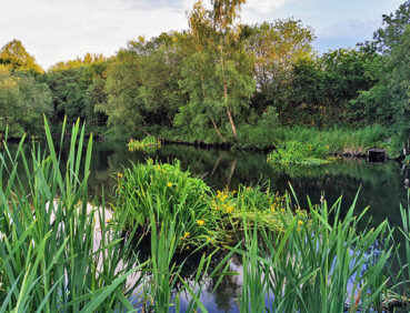
- Views over the chain of reservoirs in the Naden valley.
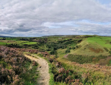
- Knowle Hill, topped by its wind farm, with panoramic views that sometimes extend all the way to Snowdonia
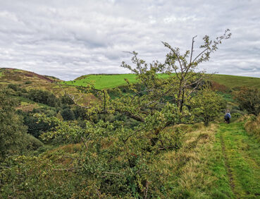
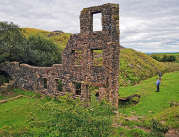
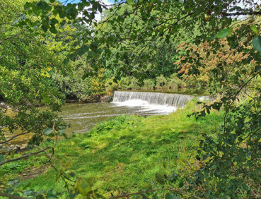
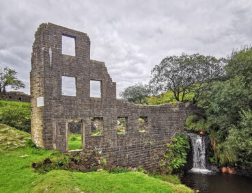
- Deeply Vale, a remote valley featuring waterfalls and evocative industrial remains
- Birtle village with its pretty cottages, church and two fine pubs
- Chesham Woods, a lovely area of mixed woodland on the edge of Bury
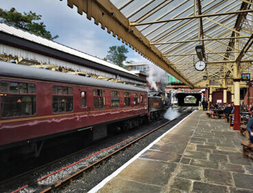
- Burrs Country Park, featuring dramatic sculptures, riverside paths and passing steam trains.
Note that parts of the trail may be damp, muddy and slippery at any time of year and especially after periods of wet weather. Please bear this in mind when planning your trip.
Be sure to keep your dog on its lead in sensitive areas, which include upland areas such as moorland, wetlands and mosslands, farmland, and parkland [such as National Trust estates]. Keeping dogs on leads helps protect both livestock and wildlife, especially ground-nesting birds.
This walk is available on the user-friendly Go Jauntly walking app. Here, photographs and written directions will enable you to follow the route on your phone. You can also download a printable PDF of the directions from the same link.
Alternatively, you can follow the route (without written directions) on the mobile-friendly Plotaroute site. To use Plotaroute on your phone’s browser, simply click the map. Then, when you’re ready to start walking, click the tracker icon (bottom right) to show your position as you follow the route.
We recommend carrying an additional power source and/or map when following online routes on your phone. For any challenging routes, we would recommend that you also have access to and know how to read an Ordnance Survey map.
This stage – rated as challenging mainly because of its length and some of the tricky paths involved – includes only one major ascent, mostly fairly gradual, within the first 2.5 miles / 4 km of the walk.
The paths used vary greatly in quality. These range from hard-surfaced multi-user paths (near Bury) and country roads (where you need to watch for vehicles) to boggy or damp paths across Knowl Hill and in the Cheesden Valley. Note that parts of the hillside path above the Naden Valley (between the 1-mile/1.6km and 2-mile/3.2 km points) are narrow, with a steep drop to the right. The path rising from Cheesden Valley at the 6-mile/9.5 km point is also fairly narrow.
Mud and puddles are very likely on certain sections.
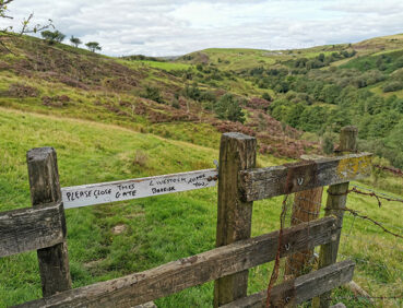
Stiles have to be crossed on the ascent from Greenbooth Reservoir near the start and on the Cheesden Valley section.
The paths and terrain encountered on this walk are shown and described on the Go Jauntly version of the walk, enabling you to make your own assessment of whether the route is accessible for you.
However, the varied terrain involved in this route means that the overall route is not suitable for wheelchairs or pushchairs. Please visit our Shorter walks page for a selection of step-free walks on the GM Ringway trail. These include a step-free walk from Bury to Burrs Country Park overlapping with part of Stage 12.
There are no public toilets en route until Burrs Country Park at the 11-mile/18-km point. However, there is a pub, café, and fish and chip shop in Norden at the start point, and then two pubs in Birtle village, at the 7-mile/11.5-km point. Further pubs and cafes can then be found in Burrs Country Park and on the subsequent route to Bury at end of the walk.
As the GM Ringway is designed around the tram, train and bus network, we recommend the use of public transport to access the start and end points. However, we also provide tips for drivers below.
Start and end points
To work out how to get to and from the walk start end points, simply click the links below to see the location in Google Maps. Then click ‘Directions’ and enter your starting location. For public transport options, click the train icon.
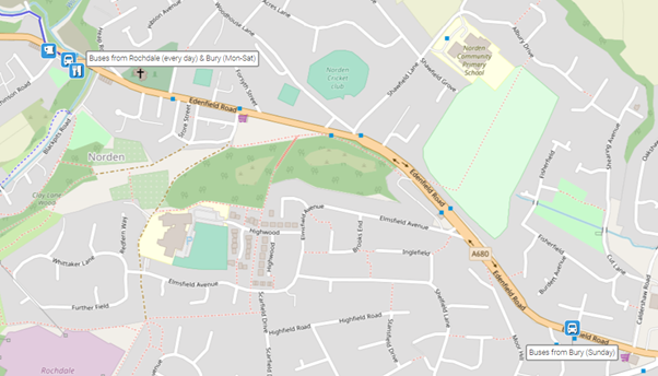
Start point: OL12 7SN
End point: Bury Interchange BL9 0AY
Alternatively, input the locations shown on this page into the TfGM journey planner.
Public transport
This trail stage connects Norden, served by buses from Bury and Rochdale, with Bury Interchange, served by Metrolink trams to Manchester and buses to a wide range of locations. Details of bus and tram services can be found on the TfGM journey planner.
Note that the actual start point at Norden (Hutchinson Road bus stop) is served by buses every day from Rochdale but from Bury only on Mondays to Saturdays. If you wish to reach the start from Bury on a Sunday, you will therefore need to take the bus to the Grimes Street stop and walk 0.7 miles / 1 km west along Edenfield Road to the start point:
Details of bus and tram services can be found on the TfGM journey planner.
Recommended tickets
For the journey to Norden, buses within Greater Manchester cost £2 for a single ticket and £5 for an AnyBus ticket, valid for multiple bus journeys all day and obtainable from the driver (prices correct as of March 2024). For your tram journey, you will need a Metrolink ticket to cover the zones you travel through. You can check the price on the Bee Network website and then purchase your ticket from the machine at the stop or tap in and out with your bank card.
However, as you will be travelling on a mix of buses and trams (and possibly trains), then a combined day ticket might be cheaper. Check the TfGM Tickets and passes page to find the best option (selecting ‘1 day and return’ as your answer to ‘How often would you be travelling?’).
Parking
For an early start, drivers are advised to drive to the start point at Norden. There is a small car park with space for approximately 8 cars at Norden Jubilee Park (postcode OL11 5TT). If this is full, there is on-street parking on neighbouring Hutchinson Road. You can then complete the walk and return by bus from Bury (with an additional 0.6-mile / 1-km walk on Sundays). See ‘Public transport’ above.
Alternatively, you could park in Bury or Rochdale town centres and take the bus to the start point and, if necessary, from the finish point in Bury.
Cut-off points
If, for example, you only want to walk a section of the stage, the most convenient location where you can leave or access the route is at the Pack Horse Inn in Birtle village, at the 7-mile (11-km) point. This is approximately 600 metres north of the main Rochdale Old Road, from where frequent buses run to and from Bury and Rochdale 7 days a week:

For further details, see the Plotaroute map.
Two alternative routes are shown on the Plotaroute map.
For the first, in Birtle village, you turn right into a yard between cottages. You then turn immediately left onto an unusual ‘secret path’ that goes through a tunnel under one of the cottages before following the attractive path uphill with views over a pond. Although this is a public right of way, please do not linger in the yard to avoid inconveniencing the residents:

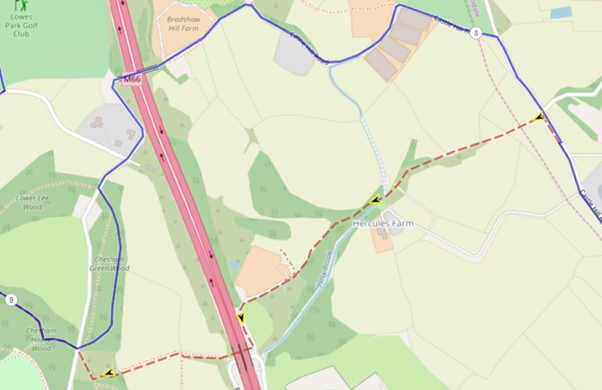
The second alternative route – again on a public right of way – entails turning left onto the footpath past Hercules Farm and through a tunnel under the M66 motorway. Although this is an attractive route, the path can be very overgrown and damp:
To give any feedback or notify us of any issues with this route, please complete this form.