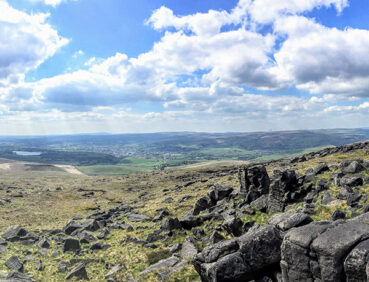
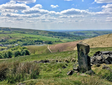
This adventurous stage of trail – with fantastic panoramic overview – features classic South Pennines scenery and offers fantastic panoramic views.
Highlights include:
- Lovely views over the chain of reservoirs in the Piethorne Valley
- A grassy ridge walks along the well-named Windy Hills, offering aerial views of Britain’s highest motorway
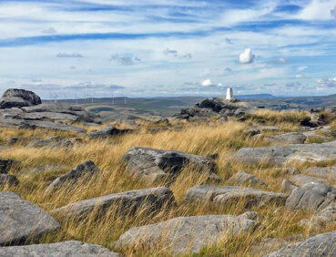
- The dramatic rocks of Blackstone Edge, called the “Andes of England” by Daniel Defoe
- A descent of Blackstone Edge “Roman Road”, actually a medieval packhorse trail
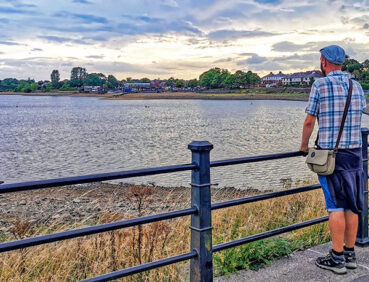
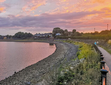
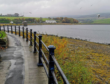
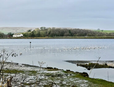
- A gentle finish via the tree-lined Ealees Valley and Hollingworth Lake, one of the largest bodies of water in Greater Manchester.
Note that parts of the trail may be damp, muddy and slippery at any time of year and especially after periods of wet weather. Please bear this in mind when planning your trip.
Be sure to keep your dog on its lead in sensitive areas, which include upland areas such as moorland, wetlands and mosslands, farmland, and parkland. Keeping dogs on leads helps protect both livestock and wildlife, especially ground-nesting birds.
This walk is available on the user-friendly Go Jauntly walking app. Here, photographs and written directions will enable you to follow the route on your phone. You can also download a printable PDF of the directions from the same link.
Alternatively, you can follow the route (without written directions) on the mobile-friendly Plotaroute site. To use Plotaroute on your phone’s browser, simply click the map. Then, when you’re ready to start walking, click the tracker icon (bottom right) to show your position as you follow the route.
We recommend carrying an additional power source and/or map when following online routes on your phone. For any challenging routes, we would recommend that you also have access to and know how to read an Ordnance Survey map.
The route includes almost 500 metres of ascent, most of which is gradual, however (although the descent from Blackstone Edge down the Roman Road is fairly steep). The walk is therefore best suited to experienced walkers with navigation and map-reading skills and could be challenging in poor visibility.
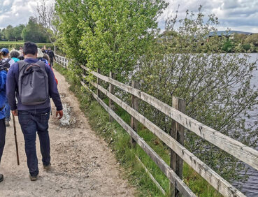
Paths are generally good, with two main exceptions. The first involves the traverse of the ‘Windy Hills’ ridge south of the M62 motorway, Here the main bridleway and other paths are unfortunately often churned up by off-road bikes, which walkers will also need to watch out for. Finally, near the end of the route, the public footpath from Hollingworth Lake to the Rochdale Canal can sometimes be very muddy and slippery. Some mud and puddles are also likely to be encountered elsewhere.
The crossing of the Pennine Way footbridge over the motorway may feel challenging to walkers prone to vertigo, even though you are protected by railings on either side. This can be avoided via a diversion shown on the Plotaroute map and described under ‘Detours and trail updates’ below.
The paths and terrain encountered on this walk are shown and described on the Go Jauntly version of the walk, enabling you to make your own assessment of whether the route is accessible for you.
However, the varied terrain involved in this route means that the overall route is not suitable for wheelchairs or pushchairs. Instead, a step-free route is available around Hollingworth Lake near the end of this stage. Please visit our Shorter walks page to see this and other step-free walks on the GM Ringway trail.
After the pub and shop at the starting point in Newhey, there are no further refreshment or toilet facilities directly on the route for the next 10 miles / 16 km of the trail. However, the White House pub can be reached after the 7-mile/11.5-km point by continuing north along the Pennine Way from Blackstone Edge. There are then public toilets (including accessible facilities) at the Hollingworth Lake visitor centre just before the 10-mile/16-km point and pubs, cafes and more toilets by the lake shore. Finally, there are several refreshment opportunities in Littleborough town centre at the end of the walk. For location details see the Plotaroute map.
As the GM Ringway is designed around the tram, train and bus network, we recommend the use of public transport to access the start and end points. However, we also provide tips for drivers below.
Start and end points
To work out how to get to and from the walk start end points, simply click the links below to see the location in Google Maps. Then click ‘Directions’ and enter your starting location. For public transport options, click the train icon.
Start point: Newhey tram stop OL16 3RN
End point: Littleborough station OL15 8AR
Alternatively, input the locations shown on this page into the TfGM journey planner.
Public transport
This trail stage connects Newhey tram stop, served by Metrolink trams from Manchester, Oldham and Rochdale, with Littleborough station, served by direct trains from Manchester and Rochdale. Both locations are also served by buses to and from Rochdale town centre.
Train times can be checked by visiting the National Rail website, while details of bus and tram services can be found on the TfGM journey planner.
Recommended tickets
For your tram journey, you will need a Metrolink ticket to Newhey to cover the zones you travel through. You can check the price of these on the Bee Network website and then purchase your ticket from the machine at the stop or tap in and out with your bank card.
You can check the price of a single train ticket from Littleborough to your local station on the National Rail website. Tickets can be purchased online or from the ticket office or machine at the station.
However, as you may well be travelling by a mix of trains and trams (and possibly buses), then a combined day ticket might be cheaper. Check the TfGM Tickets and passes page to find the best option (selecting ‘1 day and return’ as your answer to ‘How often would you be travelling?’).
Finally, those in the Rochdale area can also reach the start and end of this stage by bus. If so, buses within Greater Manchester cost £2 for a single ticket and £5 for an AnyBus ticket, valid for multiple bus journeys all day and obtainable from the driver (prices correct as of March 2024).
Parking
As the start and end points are on different lines, drivers may find it easiest to park at their local station and travel by tram to Newhey and return by train from Litt. See ‘Public transport’ above.
Otherwise, the best option is to park at Rochdale Railway Station Metrolink Park & Ride (postcode OL11 1JL), where there is parking for 202 vehicles and 13 disabled spaces. From there, you can travel by tram or bus to the walk start at Newhey tram stop and return by train or bus from Littleborough. Details of bus and tram services can be found on the TfGM journey planner, while train times and fares can be consulted on the National Rail website
Cut-off points
If, for example, you only want to walk a section of the stage, there are two locations that can be used to leave or to access the route after the 7-mile/11.5-km point. Here you can continue north along the Pennine Way from Blackstone Edge to reach the White House pub, served by occasional buses to and from Littleborough and Rochdale. The same service can be accessed at the junction of the Halifax Road and Blackstone Edge old road 1 mile / 1.6 km further on:
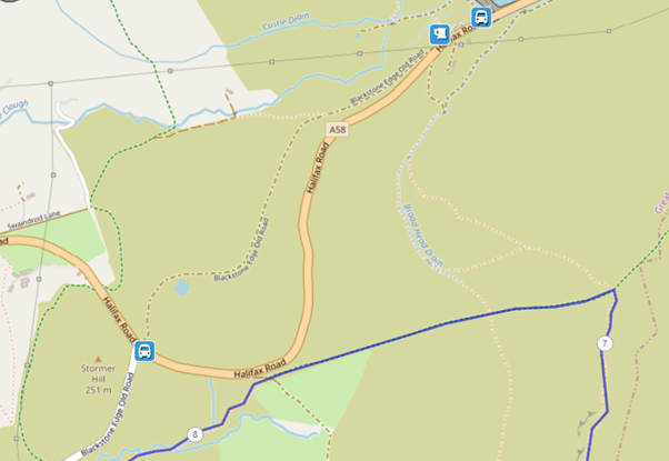
For further location details, see the Plotaroute map.
Four alternative routes are shown on the Plotaroute map.
The first represents the likely future route around Piethorne Reservoir. Use of this route adds approximately 0.5 miles / 800 metres to the overall stage length. The map and app description will be updated if and when this becomes the permanent route:

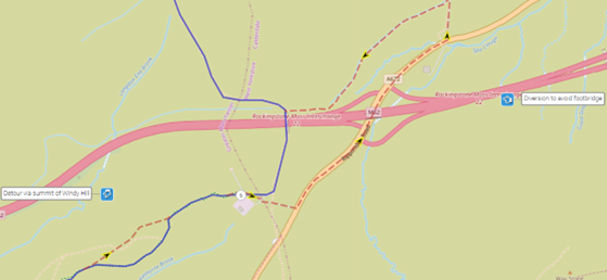
The second detour shows an alternative path (which can be muddy) over the summit of Windy Hill. The third detour, which again adds approximately 0.5 miles / 800 metres to the overall length, avoiding the footbridge over the M62 for those prone to vertigo. These are shown below:
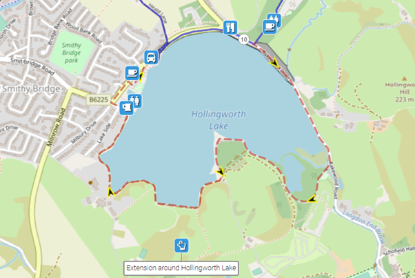
The final option involves an extension of approximately 1.5 miles / 2.3 km around the whole of Hollingworth Lake:
To give any feedback or notify us of any issues with this route, please complete this form.