Archives

Normal Pages and Posts.

Lorem ipsum dolor sit amet, consetetur sadipscing elitr, sed diam nonumy eirmod tempor invidunt ut labore et dolore magna aliquyam erat, sed diam voluptua. At vero eos et accusam et justo duo dolores et ea rebum.
Lorem ipsum dolor sit amet, consetetur sadipscing elitr, sed diam nonumy eirmod tempor invidunt ut labore et dolore magna aliquyam erat, sed diam voluptua. At vero eos et accusam et justo duo dolores et ea rebum.
Lorem ipsum dolor sit amet, consetetur sadipscing elitr, sed diam nonumy eirmod tempor invidunt ut labore et dolore magna aliquyam erat, sed diam voluptua. At vero eos et accusam et justo duo dolores et ea rebum.
Accordion Content….
Accordion Content…
Accordion Content…
History
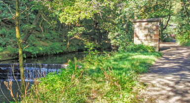
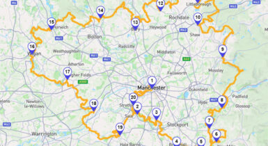
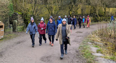
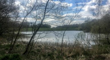
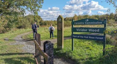
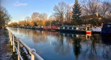
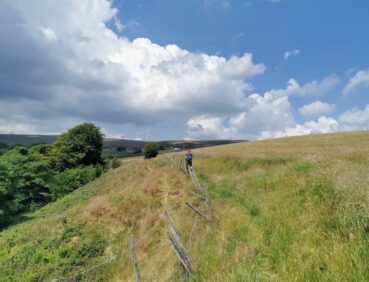
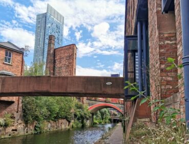
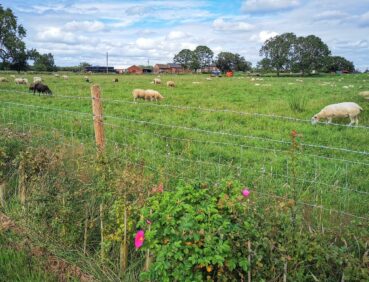
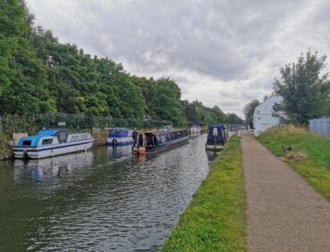
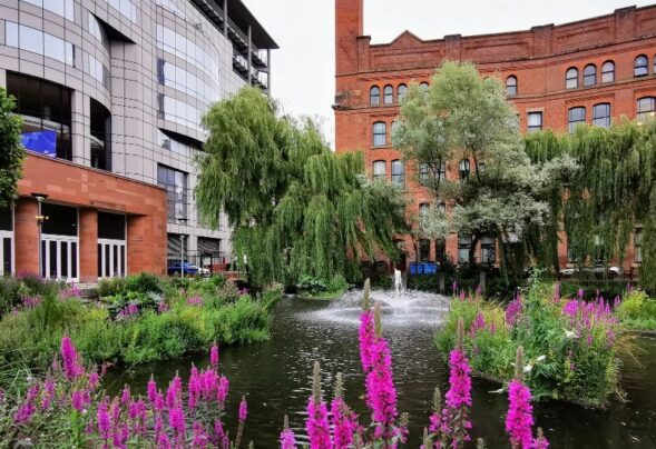
The GM Ringway is Greater Manchester’s walking trail. Covering all ten boroughs of the city-region, the trail explores an astonishing variety of landscapes, including parks, waterways and beautiful countryside.
Easily accessed by public transport, each of the trail’s 20 stages offers a unique walking experience. The GM Ringway visits some of the region’s most iconic landscapes, including historic canals, the Mersey Valley, the Peak District National Park, the South and West Pennines, and the new ‘Flashes of Wigan and Leigh’ National Nature Reserve.
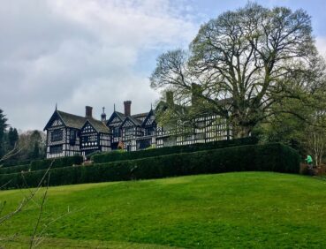
In addition to its natural beauty, the GM Ringway also gives residents and visitors the opportunity to explore Greater Manchester’s rich cultural heritage. The route passes more than 40 Grade I and II*-listed buildings, including Bramall Hall in Stockport and Ordsall Hall in Salford, 13 accredited museums, such as Trafford’s Imperial War Museum, and 14 scheduled ancient monuments including Blackstone Edge Roman Road in Rochdale.
This walk is available on the user-friendly Go Jauntly walking app. Here, photographs and written directions will enable you to follow the route on your phone. You can also download a printable PDF of the directions from the same link.
Alternatively, you can follow the route (without written directions) on the mobile-friendly Plotaroute app. To use Plotaroute on your phone’s browser, simply click the map. Then, when you’re ready to start walking, click the tracker icon (bottom right) to show your position as you follow the route.
We recommend carrying an additional power source and/or map when following online routes on your phone. For any challenging routes, we would recommend that you also have access to and know how to read an Ordnance Survey map.

Open the walk in the app
The route can be followed, downloaded or printed using the mobile-friendly Plotaroute site. To use Plotaroute on your phone’s browser, simply click the map. Then, when you’re ready to start walking, click the tracker icon (bottom right) to show your position as you follow the route. We recommend carrying an additional power source and/or map when following online routes on your phone.
Heading goes in this box
Covering All Ten Boroughs Of The City-Region, The Trail Explores An Astonishing Variety Of Landscapes, Including Parks, Waterways And Beautiful Countryside.
- Easy access by public transport
- Flashes of Wigan and Leigh’ National Nature Reserve
- South and West Pennines
- The Mersey Valley
- The Peak District National Park
- 14 ancient monuments
- Grade I and II-listed buildings
- Historic canals
