Please note that temporary re-routing can affect all stages of the GM Ringway, sometimes at very short notice. For the latest updates on any diversions we are aware of, please check the latest ‘Detours and Trail Updates’ information. This can be found on each individual GM Ringway stage profile in the ‘Routes’ section of this site.
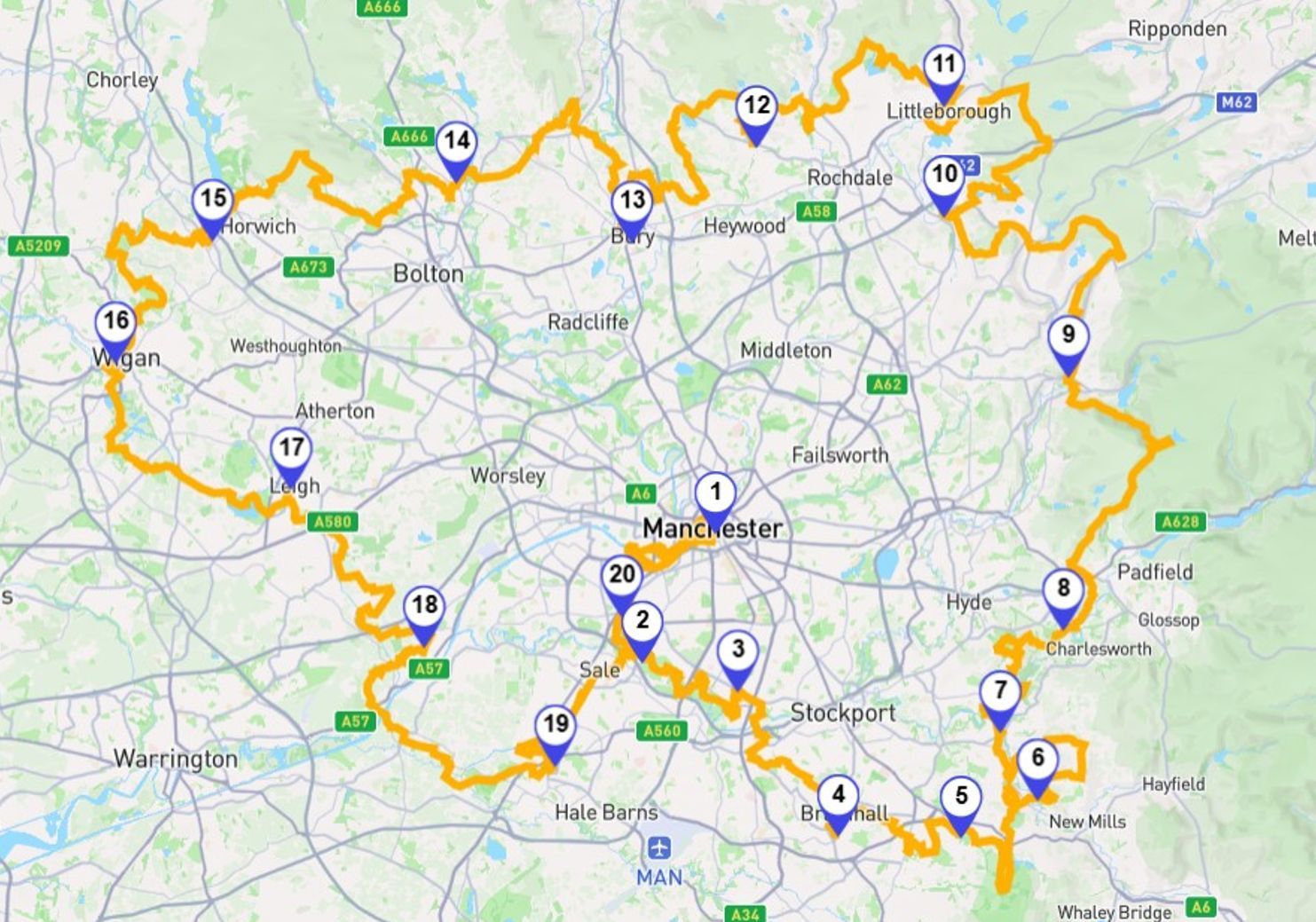
Stage 1: Fully open. However, on the Plotaroute map, we now show an optional hard-surfaced alternative that avoids the boggy section through Turn Moss. This will be indicated on the Go Jauntly app shortly.
Stage 2: Fully open apart from the long-term diversion due to the closure of the Bailey Bridge near Chorlton Water Park. Manchester City Council is installing a new bridge, now due to be completed by the end of December. The new bridge will finally allow walkers to use the original route via Kenworthy Woods.
Stage 3: A diversion remains in place along the Ladybrook Valley west of Bramhall Park due to path improvement works. The diversion is shown on the Go Jauntly app and the Plotaroute map.
Stage 4: Fully open.
Stage 5: Fully open but some eroded sections, where care is needed, on the riverside sections between the Canal and Lyme Park. There are also some missing waymarks near Disley Golf Course on the section north of the A6 (after exiting Lyme Park), and a small route change, signed on the ground, further north between Stanleyhall Wood and Turf Lea Road. Please follow the route on the Go Jauntly app or Plotaroute map if necessary.
Stage 6: Fully open.
Stage 7: Fully open.
Stage 8: Now fully open again after the summer wildfires. However, due to the challenging terrain on this stage, some might prefer to follow our easier Stage 8 alternative route on the Plotaroute map (also detailed as a standalone walk with step-by-step instructions on the Go Jauntly app).
Stage 9: Fully open.
Stage 10: A new long-term diversion is in place on the final section of this stage due to building works between Hollingworth Lake and the Rochdale Canal. Please follow the diversion along Hollingworth Road shown on the Go Jauntly app and the Plotaroute map.
Stage 11: The major diversion at the start of the walk remains in place pending a route revision. This involves following Hare Hill Road and then Calderbook Road from Littleborough town centre to join the main route shortly after the 1.5-mile/2.5-km point. For details, see the Go Jauntly app and the Plotaroute map. The remainder of the stage is fully open as Healey Dell viaduct has now been reopened.
Stage 12: Fully open.
Stage 13: Fully open.
Stage 14: Shortly after the start, the route has been amended slightly due to a landslip by Eagley Brook. The revised route is signed on the ground and shown on the Go Jauntly app and Plotaroute map.
Stage 15: Fully open but with a permanent diversion for those with dogs due to restrictions at Worthington Lakes.
Stage 16: Fully open but with a slightly revised route along the waterside at Pennington Flash. The revised route is signed on the ground and shown on the Go Jauntly app and Plotaroute map.
Stage 17: Fully open.
Stage 18: Fully open.
Stage 19: Fully open.
Stage 20: Fully walkable with a minor diversion in the city centre where the trail crosses the River Irwell. For details, see the Go Jauntly app and the Plotaroute map..
Note that even where the GM Ringway is fully open, many areas are likely be damp and muddy after recent wet weather.
For any specific questions, feedback or guidance, feel free to email us at info@gmringway.org.

Project partners