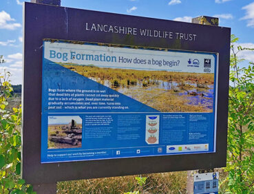
This section of the trail explores the Wigan and Salford Mosslands. This peaceful area, formerly used for peat extraction, has benefited from extensive regeneration and is home to more than 150 bird species, rare mammals, amphibians, dragonflies, butterflies and plants.
Highlights include:
- Hope Carr Nature Reserve, which boasts a complex array of wetland habitats
- Footpaths along the valley of the tranquil River Glaze (or Glazebrook)
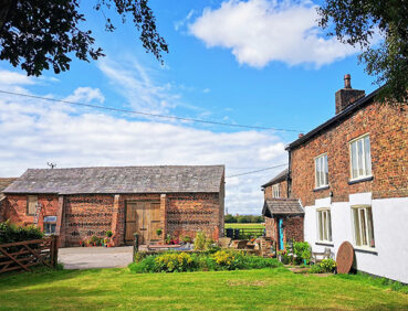
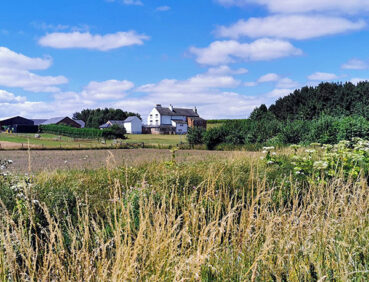
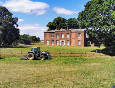
- Views of three historic country homes (Light Oaks Hall, Little Woolden Hall and Great Woolden Hall)
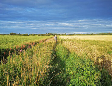
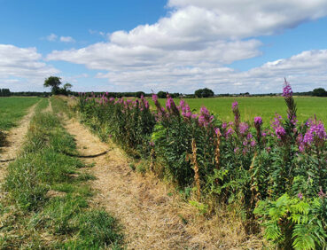
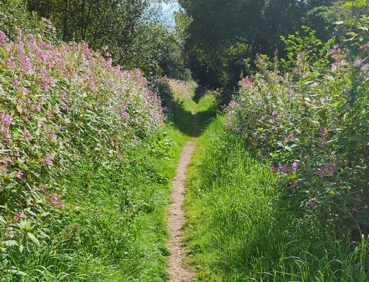
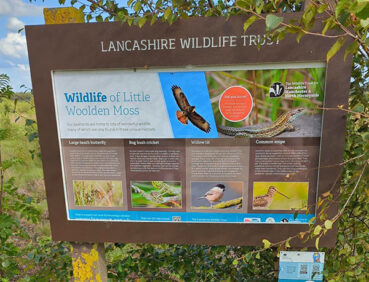
- The 115-hectare Little Woolden Moss nature reserve, restored by Lancashire Wildlife Trust and now home to plant species such as sphagnum moss and cottongrass, birds of prey and ground-nesting birds, and animals such as the common lizard and bog bush cricket
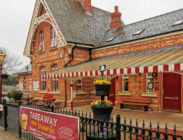
- Irlam Station, with its delightful linear park, restored signal box and friendly cafe.
Note that parts of the trail may be damp, muddy and slippery at any time of year and especially after periods of wet weather. Please bear this in mind when planning your trip.
Be sure to keep your dog on its lead in sensitive areas, which include upland areas such as moorland, wetlands and mosslands, farmland, and parkland. Keeping dogs on leads helps protect both livestock and wildlife, especially ground-nesting birds.
This walk is available on the user-friendly Go Jauntly walking app. Here, photographs and written directions will enable you to follow the route on your phone. You can also download a printable PDF of the directions from the same link.
Alternatively, you can follow the route (without written directions) on the mobile-friendly Plotaroute site. To use Plotaroute on your phone’s browser, simply click the map. Then, when you’re ready to start walking, click the tracker icon (bottom right) to show your position as you follow the route.
We recommend carrying an additional power source and/or map when following online routes on your phone. For any challenging routes, we would recommend that you also have access to and know how to read an Ordnance Survey map.
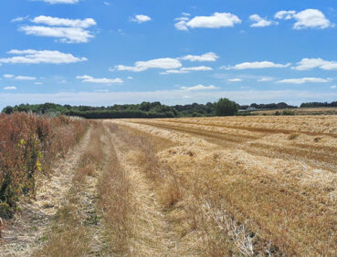
The whole route is very level. Paths vary in quality. Apart from the pavements followed in Leigh and Irlam, well-made pathways around Little Woolden Moss, and unpaved roads, much of the route is on earthen or gravel paths. Mud and puddles are likely on certain sections.
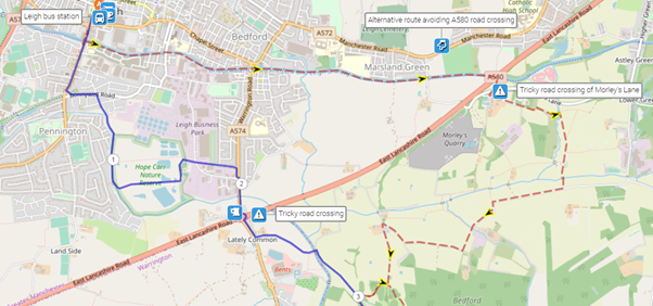
You will need to take special care when crossing the four-lane A580 (East Lancs) road near the Greyhound roundabout southeast of Leigh. A longer route avoiding this is outlined in ‘Diversions and trail updates’ below and shown on the Plotaroute map.
The paths and terrain encountered on this walk are shown and described on the Go Jauntly version of the walk, enabling you to make your own assessment of whether the route is accessible for you.
However, the varied terrain involved in this route means that the overall route is not suitable for wheelchairs or pushchairs. Please visit our Shorter walks page for a selection of step-free walks on the GM Ringway trail.
Apart from the payable public toilets at the start in Leigh bus station (and nearby pubs and cafes) and the toilets (available to non-customers) in the Station Café in Irlam, there are few facilities directly on the route. Please bear this in mind when planning your walk.
However, there is a pub and, behind the petrol station, a fast-food outlet (with toilets) on the Greyhound roundabout just after the 2-mile/3.2-km point. In addition, a little way off the route there is a pub in Glazebury close to the 3.5-mile/6-km point. After this point, there are no further refreshment and toilet opportunities until you reach Irlam.
As the GM Ringway is designed around the tram, train and bus network, we recommend the use of public transport to access the start and end points. However, we also provide tips for drivers below.
Start and end points
To work out how to get to and from the walk start end points, simply click the links below to see the location in Google Maps. Then click ‘Directions’ and enter your starting location. For public transport options, click the train icon.
Start point: Leigh bus station WN7 4LP
End point: Irlam station M44 5AB
Alternatively, input the locations shown on this page into the TfGM journey planner.
Public transport
This trail stage connects Leigh bus station, served by express buses from Manchester and Salford and other buses from Wigan, Bolton and elsewhere, with Irlam station, served by direct trains from Manchester and Warrington. Train times can be checked by visiting the National Rail website, while details of bus and tram services can be found on the TfGM journey planner.
Recommended tickets
To travel to Leigh, buses within Greater Manchester cost £2 for a single ticket and £5 for an AnyBus ticket, valid for multiple bus journeys all day and obtainable from the driver (prices correct as of March 2024). To return from Irlam by train, you can purchase a single ticket to your local station. You can check the price of these on the National Rail website. Tickets can be purchased online or from the ticket office or machine at the station.
However, as you will be travelling on a mix of buses and trains (and possibly trams), then a combined day ticket might be cheaper. Check the TfGM Tickets and passes page to find the best option (selecting ‘1 day and return’ as your answer to ‘How often would you be travelling?’).
Parking
As the start and end points are on different lines (bus in the case of Leigh, and train in the case of Irlam), drivers are advised to use public transport for both their outward and return journey. See ‘Public transport’ above.
Otherwise, the best option for an early start is to park in Leigh town centre near the bus station, either at the Town Hall car park (postcode WN7 1YA) or Spinning Gate surface car park (postcode WN7 4PD). For details and prices, see the Wigan council website. You can then complete the walk and return to your car by public transport, using either Google Maps or the TfGM journey planner to work out the best route (average journey time 1 hour 15 minutes).
Alternatively, park at the finish point using the Irlam Rail Park and Ride (postcode M44 5ZR), which has 66 spaces with 4 disabled spaces. Then use either Google Maps or the TfGM journey planner to work out the best way to get to the walk start point in Leigh.
Cut-off points
If, for example, you only want to walk a section of the stage, there is only one location after the first 2 miles/3.2 km where public transport can be used to leave or to access the route. This is at Glazebury (about 300 metres west of the 3.5-mile/6-km point), served by buses to and from Leigh. For details, see the Plotaroute map.
Three diversions are shown on the Plotaroute map.
The first involves a fairly long extension that avoids a crossing the very busy four-lane A580 (East Lancs) road south of Leigh. Although the GM Ringway now uses the safest possible crossing point near the Greyhound roundabout, some might wish to avoid this. The alternative route follows the canal eastwards (to pass under the A580) and a series of field paths and country roads to rejoin the main route near Windy Bank Wood. This adds 2 miles / 3.5 km to the overall distance:
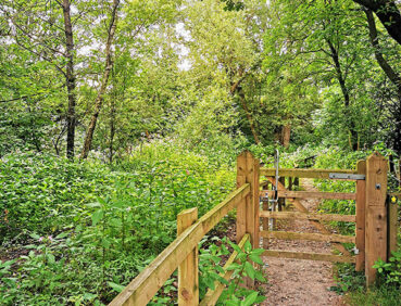
The second detour is an optional extension around Windy Bank Wood, an attractive area of native woodland and new planting. Following this route adds just over 1 mile / 1.6 km to the overall distance:

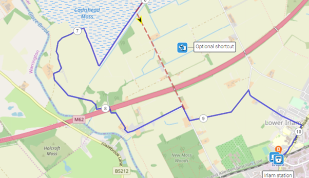
In contrast, you can cut 1.8 miles/2.9 km off the stage length by simply following the unpaved Moss Road south from Little Woolden Moss:
To give any feedback or notify us of any issues with this route, please complete this form.