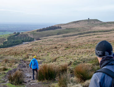
This challenging walk can be seen as the climax of the whole GM Ringway as it includes an ascent of Winter Hill, the final ‘big hill’ of the whole route and a location visible from many of the previous and following stages of the trail. The walk requires good visibility and is best suited to those with map-reading and navigation skills, due to the remote and high ground covered.
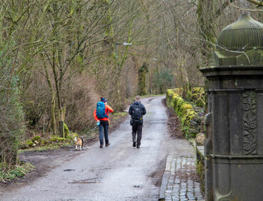
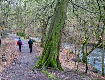
- Lovely riverside walking along the valley of Eagley Brook
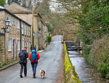
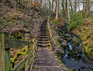
- The picturesque village of Barrow Bridge with its cottages and ‘Miner’s Steps’
- The ascent of Winter Hill through the Smithills Estate, including a plaque commemorating the mass trespass of 1896
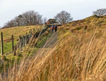
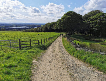
- Panoramic views on both the ascent of Winter Hill and the descent via the mini-summit of ‘Two Lads’
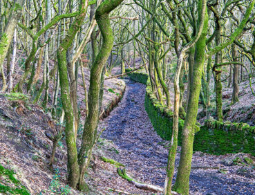
- The semi-ancient woodland of Wilderswood, followed by the chance to visit the little-known Tiger’s Clough waterfall.
Note that parts of the trail may be damp, muddy and slippery at any time of year and especially after periods of wet weather. Please bear this in mind when planning your trip.
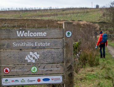
Be sure to keep your dog on its lead in sensitive areas, which include upland areas such as moorland, wetlands and mosslands, farmland, and parkland, such as the Woodland Trust’s Smithills Estate. Keeping dogs on leads helps protect both livestock and wildlife, especially ground-nesting birds.
Also note there is now a PSPO (public spaces protection order) in force on Winter Hill to prevent wildfires. Please therefore avoid any activity that could start fires and contact the emergency services immediately if you witness any such activity.
This walk is available on the user-friendly Go Jauntly walking app. Here, photographs and written directions will enable you to follow the route on your phone. You can also download a printable PDF of the directions from the same link.
Alternatively, you can follow the route (without written directions) on the mobile-friendly Plotaroute site. To use Plotaroute on your phone’s browser, simply click the map. Then, when you’re ready to start walking, click the tracker icon (bottom right) to show your position as you follow the route.
We recommend carrying an additional power source and/or map when following online routes on your phone. For any challenging routes, we would recommend that you also have access to and know how to read an Ordnance Survey map.
The route includes almost 500 metres of ascent and descent, the great majority consisting of the climb of Winter Hill. However, the climb is mostly fairly gradual on clear but in places boggy paths. Wayfinding, particularly on the ascent of the hill, could be challenging in foggy conditions.
Overall, a wide variety of path surfaces are used, from pavements and the tarmac-surfaced Winter Hill access road to grassy or earthen field and riverside paths. Mud and puddles are very likely on certain sections.
The paths and terrain encountered on this walk are shown and described on the Go Jauntly version of the walk, enabling you to make your own assessment of whether the route is accessible for you.
However, the varied terrain involved in this route means that the overall route is not suitable for wheelchairs or pushchairs. Please visit our Shorter walks page for a selection of step-free walks on the GM Ringway trail. The Woodland Trust is currently increasing the number of accessible paths across the Smithills Estate, which is explored on this trail stage.
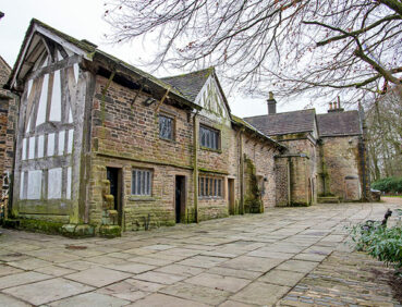
Public toilets, including accessible facilities are available at Smithills Hall, just before the 4-mile/6.5 km point when the hall is open (Wednesday – Sunday inclusive as of April 2024). Check the Smithills Hall website for the latest opening hours. A temporary festival-style toilet can also be found at Walker Fold car park near the 6-mile/9-km point. The toilets at Rivington motorway services are only a short way from the 12.5-mile/20-km point.
Except on the highest moorland part of the walk, a good number of refreshment opportunities are available. These include pubs at the walk start and end points, a useful shop with take-away drinks and snacks on Belmont Road, a cafe at Smithills Hall (on Wednesdays to Sundays), a coffee van at Walker Fold car park, and a snack shack on the descent from Winter Hill. For location details, see the Plotaroute map.
As the GM Ringway is designed around the tram, train and bus network, we recommend the use of public transport to access the start and end points. However, we also provide tips for drivers below.
Start and end points
To work out how to get to and from the walk start end points, simply click the links below to see the location in Google Maps. Then click ‘Directions’ and enter your starting location. For public transport options, click the train icon.
Start point: Bromley Cross station BL7 9LY
End point: Blackrod station BL6 5JH
Alternatively, input the locations shown on this page into the TfGM journey planner.
Public transport
This trail stage connects Bromley Cross and Blackrod train stations, both served by direct trains from Bolton and Manchester. Buses also connect both locations with Bolton Interchange. Train times can be checked by visiting the National Rail website, while details of bus and tram services can be found on the TfGM journey planner.
Recommended tickets
If you are travelling only by train from locations within Greater Manchester, you can purchase single tickets to Bromley Cross and from Blackrod. You can check the price of these on the National Rail website. Tickets can be purchased online or from the ticket office or machine at the station.
Depending on your starting location, a Greater Manchester Rail Ranger may be cheaper. This can be used on any train (and trams within the city centre) all day on weekends and bank holidays at off-peak times on weekdays. For details, see this page.
If you are travelling by a mix of trains, buses or trams, then a combined day ticket might be cheaper. Check the TfGM Tickets and passes page to find the best option (selecting ‘1 day and return’ as your answer to ‘How often would you be travelling?’).
Finally, those in the Bolton area can also reach the start and end of this stage by bus. If so, buses within Greater Manchester cost £2 for a single ticket and £5 for an AnyBus ticket, valid for multiple bus journeys all day and obtainable from the driver (prices correct as of March 2024).
Parking
As the start and end points are on different lines, drivers may find it easiest to park at their local station and travel by train to Bromley Cross and from Blackrod. See ‘Public transport’ above.
Otherwise, the best option is to park in Bolton town centre, near the train station and Bolton Interchange. The closest car park is Bolton Octagon Theatre Multi-Storey Car Park (postcode BL1 1SN), where there is parking for 473 vehicles and 4 disabled spaces. From Bolton station, you can then travel by train to Bromley Cross, returning from Blackrod. The same journeys can also be made by bus from Bolton Interchange, next to the station.
Another alternative is to park at the walk start point, at Bromley Cross station, where 71 spaces are available. You can then return by train from Blackrod, changing in Bolton.
Details of bus and tram services can be found on the TfGM journey planner, while train times and fares can be consulted on the National Rail website.
Cut-off points
If, for example, you only want to walk a section of the stage, the most useful location to leave or to access the route is at the 5-mile/8-km point in Barrow Bridge village, just before the ascent of Winter Hill. Other locations served by buses to and from Bolton are shown on the Plotaroute map.
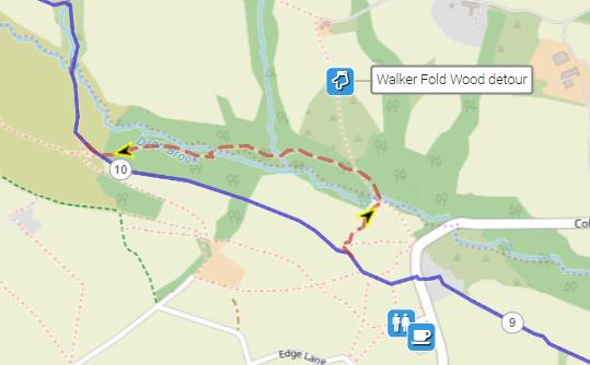
Two short optional detours routes are shown on the Plotaroute map. The first involves a loop on good paths through Walker Fold Wood:
The second entails an extension to the summit and trig point of Winter Hill, from where there are very good views north across Lancashire:

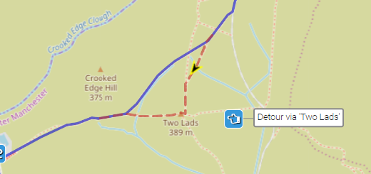
Finally, on the descent from Winter Hill, you can divert over the subsidiary summit of ‘Two Lads’, from where there are excellent views across Greater Manchester:
To give any feedback or notify us of any issues with this route, please complete this form.