This fairly challenging route – due to its length, the ascents and descents involved, and some tricky route-finding – offers fantastic views as well as some beautiful riverside and woodland scenery.
Highlights include:
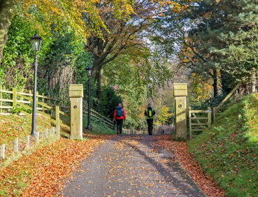
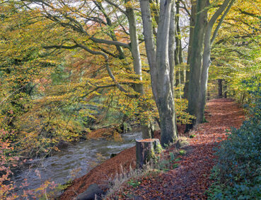
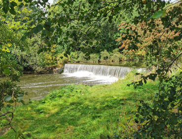
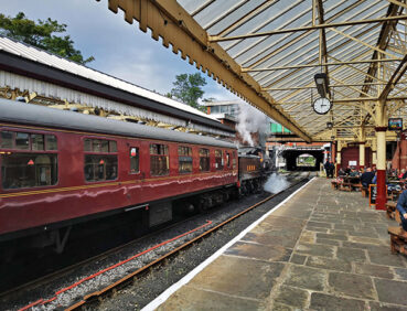
- Riverside walking along the Irwell with views, if you’re lucky, of passing steam trains
- The delightful Holcombe Brook in its narrow tree-lined valley
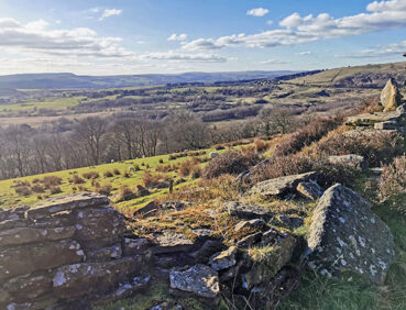
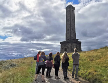
- A gradual ascent of Holcombe Hill topped by the famous Peel Tower, offering stunning views across the West Pennines and Manchester
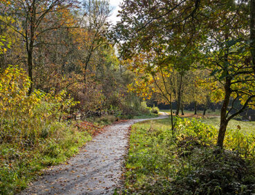
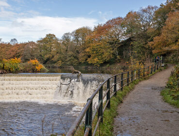
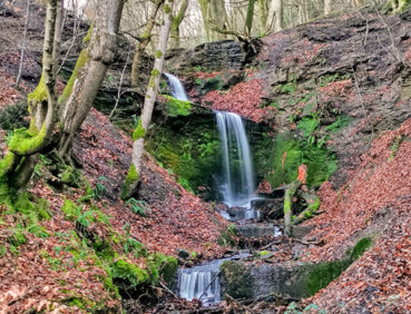
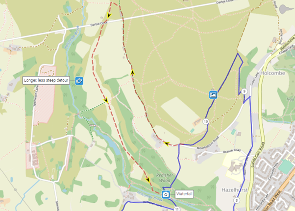
- Semi-ancient woodlands and a waterfall in the peaceful Redisher Wood
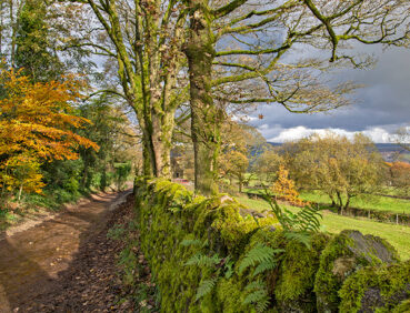
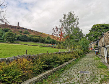
- Affetside village with its ancient cross and hilltop location on a Roman road
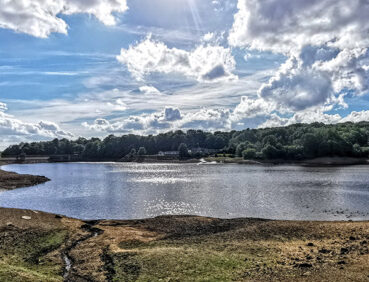
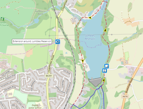
- An optional circuit of Jumbles Reservoir.
Note that parts of the trail may be damp, muddy and slippery at any time of year and especially after periods of wet weather. Please bear this in mind when planning your trip.
Be sure to keep your dog on its lead in sensitive areas, which include upland areas such as moorland, wetlands and mosslands, farmland, and parkland. Keeping dogs on leads helps protect both livestock and wildlife, especially ground-nesting birds.
This walk is available on the user-friendly Go Jauntly walking app. Here, photographs and written directions will enable you to follow the route on your phone. You can also download a printable PDF of the directions from the same link.
Alternatively, you can follow the route (without written directions) on the mobile-friendly Plotaroute site. To use Plotaroute on your phone’s browser, simply click the map. Then, when you’re ready to start walking, click the tracker icon (bottom right) to show your position as you follow the route.
We recommend carrying an additional power source and/or map when following online routes on your phone. For any challenging routes, we would recommend that you also have access to and know how to read an Ordnance Survey map.
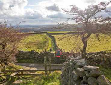
While the first 5 miles / 8 km of this stage are fairly level, there is a considerable amount of ascent and descent thereafter.
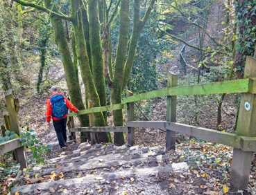
Firstly, there is a fairly steep ascent of Holcombe Hill. The zigzag route taken, however, is mainly on good paths and is as gradual as possible. The steep descent from the hill has been eased by the installation of wooden steps, which nevertheless require care, as do the paths near the waterfall at the bottom of the steps. An alternative more gradual route down is available (see ‘Detours & track updates’ below), which adds more than 1.5 miles / 2.5 km to the overall walk length. Later, there is another climb, at the 8-mile / 13-km point, steep in parts, from Hawkshaw Village to the hilltop village of Affetside. The descent from here is gentle and on good paths.
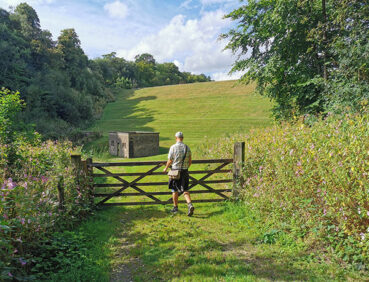
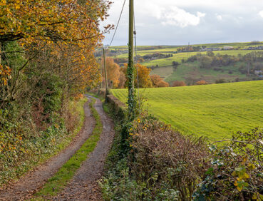
Overall, a wide mix of path surfaces are encountered, from pavements and a hard-surfaced multi-user route north of Bury to stony tracks and grassy or earthen field and riverside paths.
Mud and puddles are likely on certain sections.
The paths and terrain encountered on this walk are shown and described on the Go Jauntly version of the walk, enabling you to make your own assessment of whether the route is accessible for you.
However, the varied terrain involved in this route means that the overall route is not suitable for wheelchairs or pushchairs. Please visit our Shorter walks page for a selection of step-free walks on the GM Ringway trail. These include a step-free walk from Bury to Burrs Country Park overlapping with part of Stage 13.
Public toilets are available at the start in Bury Interchange – for a charge – and in Burrs Country Park just under 2 miles / 3.2 km further on. There are also toilets near Jumbles Reservoir towards the end of the route but we have found that these are not always open. However, there are multiple pubs and cafes on or near the route in the Irwell valley, in Holcombe Brook village (before the ascent of Holcombe Hill), in Hawkshaw and Affetside villages, and in Bromley Cross at the end of the walk. For location details, see the Plotaroute map.
As the GM Ringway is designed around the tram, train and bus network, we recommend the use of public transport to access the start and end points. However, we also provide tips for drivers below.
Start and end points
To work out how to get to and from the walk start end points, simply click the links below to see the location in Google Maps. Then click ‘Directions’ and enter your starting location. For public transport options, click the train icon.
Start point: Bury Interchange BL9 0AY
End point: Bromley Cross station BL7 9LY
Alternatively, input the locations shown on this page into the TfGM journey planner.
Public transport
This trail stage connects Bury Interchange, served by Metrolink trams from Manchester and buses from a variety of locations, with Bromley Cross station, served by direct trains from Bolton and Manchester. Buses also run from here to Bolton Interchange. If you are travelling from the Bolton area, you could travel by bus to and from the start points. Train times can be checked by visiting the National Rail website, while details of bus and tram services can be found on the TfGM journey planner.
Recommended tickets
For your tram journey, you will need a Metrolink ticket to Bury to cover the zones you travel through. You can check the price of these on the Bee Network website and then purchase your ticket from the machine at the stop or tap in and out with your bank card.
You can check the price of a single train ticket from Bromley Cross to your local station on the National Rail website. Tickets can be purchased online or from the ticket office or machine at the station.
However, as you may well be travelling by a mix of trains and trams (and possibly buses), then a combined day ticket might be cheaper. Check the TfGM Tickets and passes page to find the best option (selecting ‘1 day and return’ as your answer to ‘How often would you be travelling?’).
Finally, those in the Bolton area can also reach the start and end of this stage by bus. If so, buses within Greater Manchester cost £2 for a single ticket and £5 for an AnyBus ticket, valid for multiple bus journeys all day and obtainable from the driver (prices correct as of March 2024).
Parking
As the start and end points are on different lines, drivers may find it easiest to park at their local station and travel by tram to Bury and return by train from Bromley Cross. See ‘Public transport’ above.
Otherwise, the best option is to park in Bolton town centre, near the train station and Bolton Interchange. The closest car park is Bolton Octagon Theatre Multi-Storey Car Park (postcode BL1 1SN), where there is parking for 473 vehicles and 4 disabled spaces. From Bolton Interchange, you can travel by bus to the walk start at Bury Interchange and return by train or bus from Bromley Cross. Details of bus and tram services can be found on the TfGM journey planner, while train times and fares can be consulted on the National Rail website.
Cut-off points
If, for example, you only want to walk a section of the stage, there are several locations where public transport can be used to leave or to access the route.
The first is at the Hare and Hounds pub, Holcombe Brook, just before the 5-mile/8-km point. From here, frequent buses run to and from Bury Interchange. After this, you can also access or leave the route in Hawkshaw village (at the 7.5-mile/12.5-km point) or in Affetside village (at the 9-mile/14.5-km point). These places are served by buses to both Bolton and Bury, although services are irregular, especially on Sundays. For further location details, see the Plotaroute map.
Two alternative routes are shown on the Plotaroute map.
The first involves a longer, more gradual descent from Holcombe Hill into Redisher Wood and the Holcombe Valley. While this is very attractive and on good paths, it adds more than 1.5 miles/2.5 km to the overall walk length:
The second, near the end of the walk, entails a full circuit of Jumbles Reservoir, all on very good paths. This adds approximately 1 mile/1.6 km to the overall distance:
To give any feedback or notify us of any issues with this route, please complete this form.