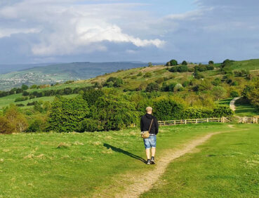
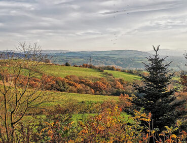
This fairly hilly stage offers a varied mix of lovely scenery along and above the valleys of the Goyt and Etherow rivers.
Highlights include:
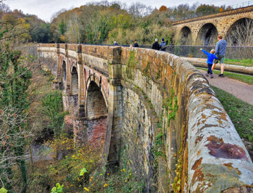
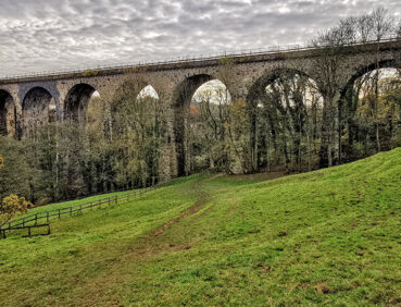
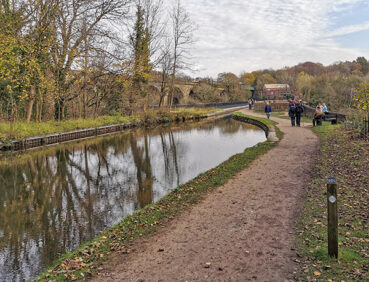
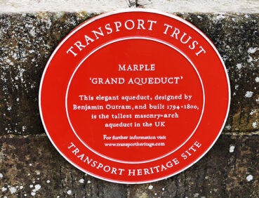
- A crossing of the astonishing Marple canal aqueduct, England’s highest
- Gorgeous waterside and woodland paths in Etherow Country Park
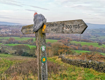
- A wander around Werneth Low, offering great views across Greater Manchester, the Peak District and the Pennines
- Streamside paths in the fairytale-like setting of Back Wood
- Industrial remains and riverside scenery near Broadbottom.
Note that parts of the trail may be damp, muddy and slippery at any time of year and especially after periods of wet weather. Please bear this in mind when planning your trip.
Be sure to keep your dog on its lead in sensitive areas, which include upland areas such as moorland, wetlands and mosslands, farmland, and parkland. Keeping dogs on leads helps protect both livestock and wildlife, especially ground-nesting birds.
This walk is available on the user-friendly Go Jauntly walking app. Here, photographs and written directions will enable you to follow the route on your phone. You can also download a printable PDF of the directions from the same link.
Alternatively, you can follow the route (without written directions) on the mobile-friendly Plotaroute site. To use Plotaroute on your phone’s browser, simply click the map. Then, when you’re ready to start walking, click the tracker icon (bottom right) to show your position as you follow the route.
We recommend carrying an additional power source and/or map when following online routes on your phone. For any challenging routes, we would recommend that you also have access to and know how to read an Ordnance Survey map.
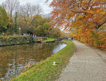
After the first three fairly level miles, there is one serious climb, from the Etherow Valley up on to Werneth Low. This is fairly gradual, however. The descent from Werneth Low is steep in places, and along with the woodland paths west of Broadbottom, requires careful footing. A mixture of paths is used, ranging from the well-made canal towpaths and paths in Etherow and Werneth Low country parks, to quiet roads (where you should watch out for traffic), and earthen paths elsewhere.
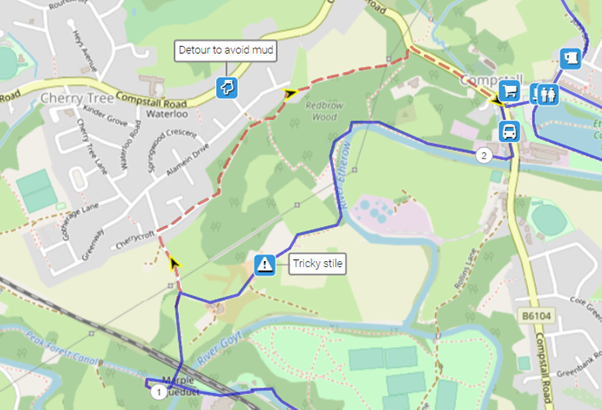
Mud and puddles are likely on certain sections, especially on the descent from Marple Aqueduct, the subsequent riverside section, and in the woodland to the southwest of Broadbottom.
The paths and terrain encountered on this walk are shown and described on the Go Jauntly version of the walk, enabling you to make your own assessment of whether the route is accessible for you.
The canal towpath north from Marple is largely level and step-free, as are many of the paths in Etherow Country Park, where accessible toilets are available. However, the varied terrain involved in this route means that the overall route is not suitable for wheelchairs or pushchairs. Please visit our Shorter walks page for a further selection of step-free walks on the GM Ringway trail.
There are pubs and cafes near the start in Marple Bridge. Just after the 2-mile (3.2-km) point, there are public toilets in Etherow Country Park as well as a café. After existing the park, the route passes the Andrew Arms pub. Close to the 6-mile (9-km) point, the Hare and Hounds pub is a short walk along Werneth Low Road. A little further on, the café (Sundays only) and toilets at Lower Higham Visitor Centre are a short walk away from the war memorial on Werneth Low. Finally, there is a pub at the end in Broadbottom and a café at Lymefield Garden Centre, approximately 0.5 miles / 800 m from Broadbottom station. For an overview of locations, see the Plotaroute map.
As the GM Ringway is designed around the tram, train and bus network, we recommend the use of public transport to access the start and end points. However, we also provide tips for drivers below.
Start and end points
To work out how to get to and from the walk start end points, simply click the links below to see the location in Google Maps. Then click ‘Directions’ and enter your starting location. For public transport options, click the train icon.
Start point: Marple station SK6 7DA
End point: Broadbottom station SK14 6AX
Alternatively, input the locations shown on this page into the TfGM journey planner.
Public transport
This trail stage connects Marple and Broadbottom stations, both served by trains 7 days a week from Manchester (but not Stockport). While Marple also has frequent bus services from Stockport, buses from Broadbottom (to Hyde and Glossop) run only on Monday to Saturday daytimes and do not provide any advantage. For this reason, unless you are travelling to Marple by bus from Stockport, we recommend using trains for both parts of the journey.
Train times can be checked by visiting the National Rail website, while details of bus and tram services can be found on the TfGM journey planner.
Recommended tickets
If you are travelling only by train from locations within Greater Manchester, you can purchase single tickets to Marple and from Broadbottom. You can check the price of these on the National Rail website. Tickets can be purchased online or from the ticket office or machine at the station.
Depending on your starting location, a Greater Manchester Rail Ranger may be cheaper. This can be used on any train (and trams within the city centre) all day on weekends and bank holidays at off-peak times on weekdays. For details, see this page.
If you are travelling by a mix of trains, buses or trams, then a combined day ticket might be cheaper. Check the TfGM Tickets and passes page to find the best option (selecting ‘1 day and return’ as your answer to ‘How often would you be travelling?’).
Parking
As the start and end points are on different train lines, drivers are advised to park at their local station and travel by train to Marple and from Broadbottom. See ‘Public transport’ above.
Otherwise, the best option is to park at Marple station, where there is a large car park. At the end of the walk, you can then return to Marple by train, changing at Ashburys or at Manchester Piccadilly on a single ticket (Broadbottom – Marple). To check times and prices, visit the National Rail website.
Cut-off points
If, for example, you only want to walk a section of the stage, the only convenient location where you can leave to access the route is in Compstall village, either at the 2-mile (3.2-km) or 3.5-mile (5.6-km) point. From here, buses run to Marple and Stockport 7 days a week. For details, see the Plotaroute map.
Two optional detours and are shown on the Plotaroute map.
The first avoids the often overgrown path to the canal right at the start after Marple station:
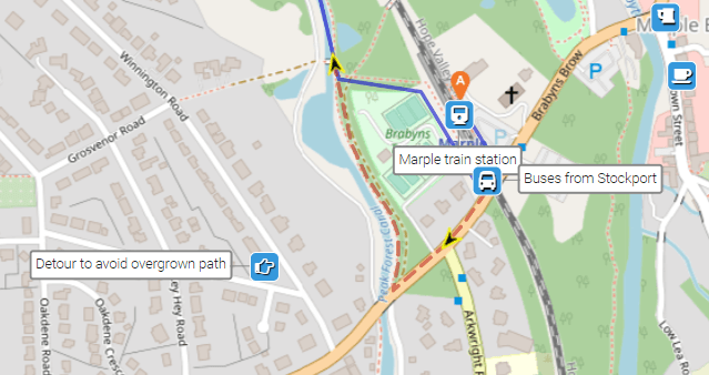
The second, via a residential road, avoid the sometimes very muddy section between Marple Aqueduct and Etherow Country Park:
To give any feedback or notify us of any issues with this route, please complete this form.
Peak & Northern Footpaths Society (PNFS) is a members-driven charity committed to protecting the rights of users of rights of way and public access land.
PNFS erects and maintains its own distinctive signposts and you can see one of these on Stage 7 at:
*Lr Watermeetings Farm, Etherow: PNFS’s map location and grid reference
PNFS are working closely with the GM Ringway to help respond to problems that you may encounter with the trail condition, including reporting issues to the relevant local authority.
To read more about PNFS visit their website at https://peakandnorthern.org.uk/ and for any issues relating to the trail condition, we would recommend you contact PNFS directly either by using the Path Checker app or via the PNFS website: Peak & Northern Footpaths Society – Report a problem (or Lost Way) (peakandnorthern.org.uk).